
Human History of Wildlands: Great River Preserve
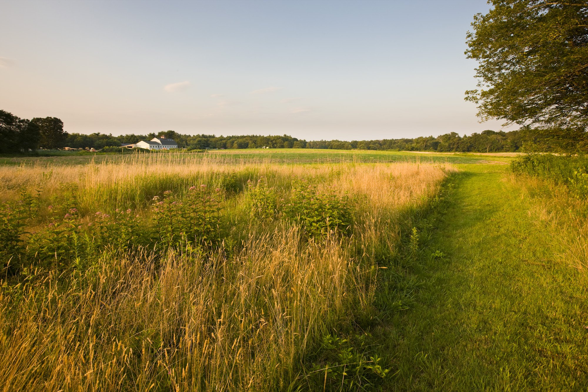
Great River Preserve in Bridgewater. Photo by Jerry Monkman.
By Skip Stuck, Key Volunteer
Throughout this "Human History of Wildlands" series, I've highlighted a wide range of ways that Native Americans, European settlers, and others have utilized and altered the Southeastern Massachusetts landscape, from clearing forests for farms to damming rivers for factories. Few parcels in our region have looked any one way for long. So, when Wildlands Trust undertakes responsibility for a new preserve, it often confronts a difficult question: Which version of the land’s history do we preserve or restore?
Great River Preserve in Bridgewater offers a unique example of a very different kind of history.
The preserve sits near the headwaters of the Taunton River. If you read our April 2024 history of the Taunton River watershed, you might remember that the retreat of the last glaciers around 12,000 years ago left this area covered in sandy soil and mud—not the rocks and boulders so prevalent elsewhere in Southeastern Massachusetts. Much later, the Taunton River's slow current would prove unsuitable for the hydropower generation that elsewhere fueled mills and factories. The land has thus continued to support high-quality forests and farms for generations.
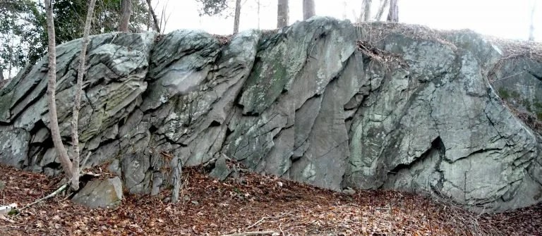
Sachem Rock. Source: Sowams Early History
Early History
In 1647, a group of settlers known as the "Conihassett Partners" (derived from the Wampanoag name for a section of present-day Scituate) decided to expand their land holdings beyond the coast and obtained the first land grant for a large inland area. In 1649, at a place called Sachem Rock (close to today's Great River Preserve), the Wampanoag sachem Massasoit met with colonists including Miles Standish. There, Standish purchased 14 square miles of land that came to be known as Old Bridgewater. The purchase price included "7 coats, 9 hatchets, 8 hoes, 20 knives, 4 moose skins, and 10 and 1/2 yards of cotton." This is believed to be the first signed agreement in North America between the colonists and Native people.
Soon, colonists settled in the area, and Old Bridgewater split into four Bridgewaters—East, West, North (now Brockton), and Bridgewater proper. One of the earliest farms was Sachem Rock Farm in East Bridgewater, established in 1665. As the area grew, present-day Auburn Street became a main thoroughfare. In 1790, the Auburn Street Bridge, eventually known as the Covington Bridge, was built, connecting Bridgewater with Halifax to the east and Middleboro to the south. This bridge operated for over 200 years through multiple replacements and repairs until 1995, when it was finally dismantled.
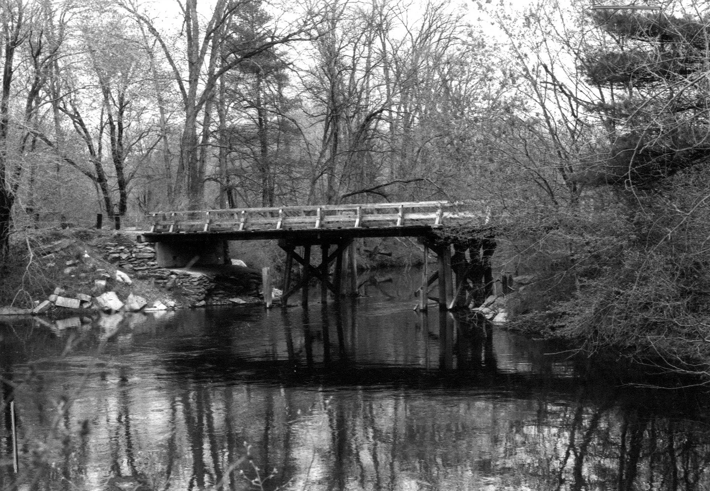
Auburn Street Bridge, 1981. Source: Recollecting Nemasket
In 1770, a Cape-style house that came to be known as the Leonard–Jackson House was built on a large farm on Auburn Street. This house has been in continuous use since, owned by the Leonard, Jackson, Brooks, and Belchunas families, among others, before ending up with the Lehtola family from 1945 to the present day.
From the late 1600s until the early 2000s, the land of Great River Preserve was in continuous use as a farm, pasturing cattle and horses and producing corn and hay. Unlike almost every other property in the region, this land likely looked in the 1700s much the same as it does today.
Protecting the Land
Owners Peter and Rita Lehtola were concerned that as they phased out farming activities, the land could be divided, developed, and changed forever. Then, Wildlands Trust Board Chair Howard Randall approached the Lehtolas with an idea of how it could be preserved. In 2008, the Lehtola family agreed to sell 230 acres of the property to MassWildlife and Wildlands Trust. Of those acres, 125 became Great River Preserve, while the remainder augmented MassWildlife’s Taunton River Wildlife Management Area, which today totals 349 acres. To make the agreement possible, Wildlands’ Board of Directors agreed to change a longstanding "no hunting" policy on their properties and allow hunting at Great River in a carefully regulated manner. This marked an important public-private collaboration, and a blueprint for future preservation efforts.
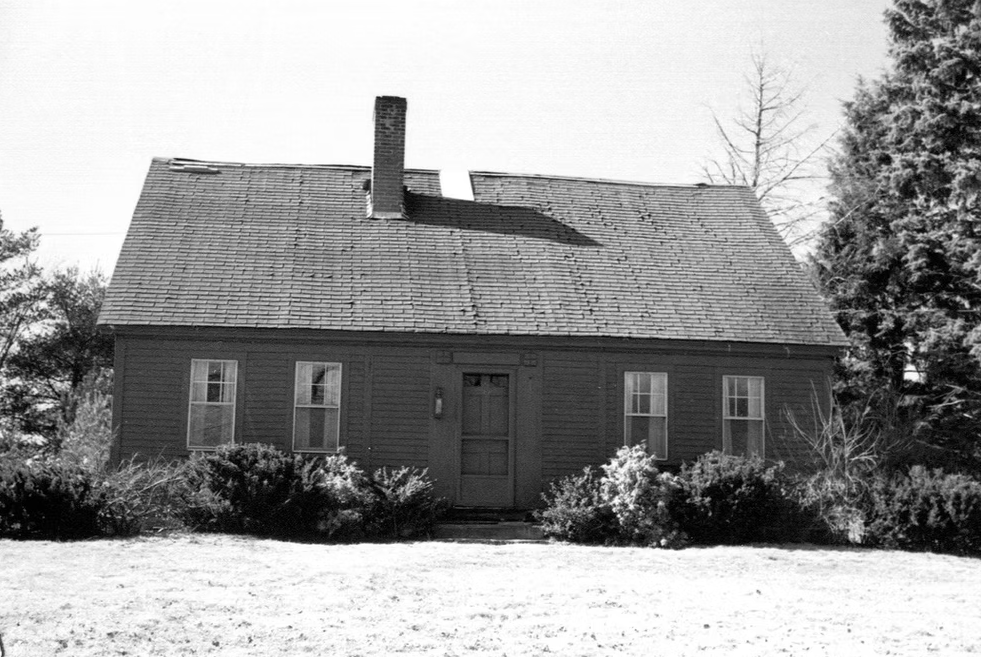
Leonard–Jackson House, 1984. Source: Bridgewater Archive
The protection project forever secured the future of a 1,400-acre open space corridor along 1.5 miles of the Taunton River. Since the acquisition, Wildlands has worked diligently to keep the fields hayed and forests healthy, so that the land’s character can persist at a time when farms of all kinds are going out of business and being swallowed up by development.
We hope you will visit Great River Preserve and seize the rare opportunity to see what farmers and settlers saw for 300 years.
A special thanks to the Lehtola family, without whose insights and recollections this piece would not have been possible. And as always, thanks to Thomas Patti, Wildlands’ Communications Coordinator.
Resources
“Leonard-Jackson House,” Bridgewater Archive. bridgewaterarchive.com/locations/houses/13
“Sachem’s Rock where Ousamequin traded with Myles Standish for Satucket lands in 1649.” Sowam’s Early History. sowamsearlyhistory.org/sachems-rock-where-osamequin-traded-with-myles-standish-for-satucket-lands-in-1649/
“Auburn Street Bridge,” Recollecting Nemasket. nemasket.blogspot.com/2013/03/auburn-street-bridge.html
East Bridgewater Library: eastbridgewaterlibrary.org
“Human History of Wildlands: The Taunton River Watershed," Wildlands Trust.
“Taking the Long Way Around,” John Stilgoe, Boston Globe. March 14, 2004.
Interview with Peter Lehtola, March 26, 2026.