What’s New at Wildlands
Human History of Wildlands: Great River Preserve
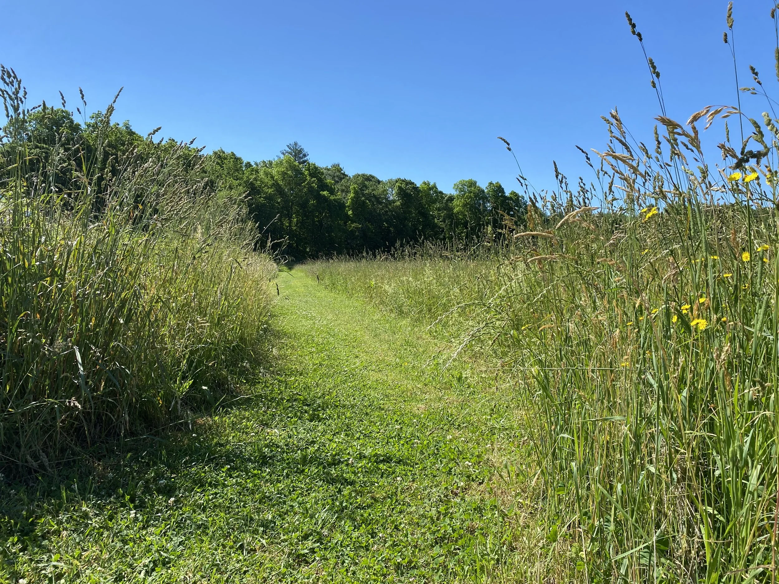
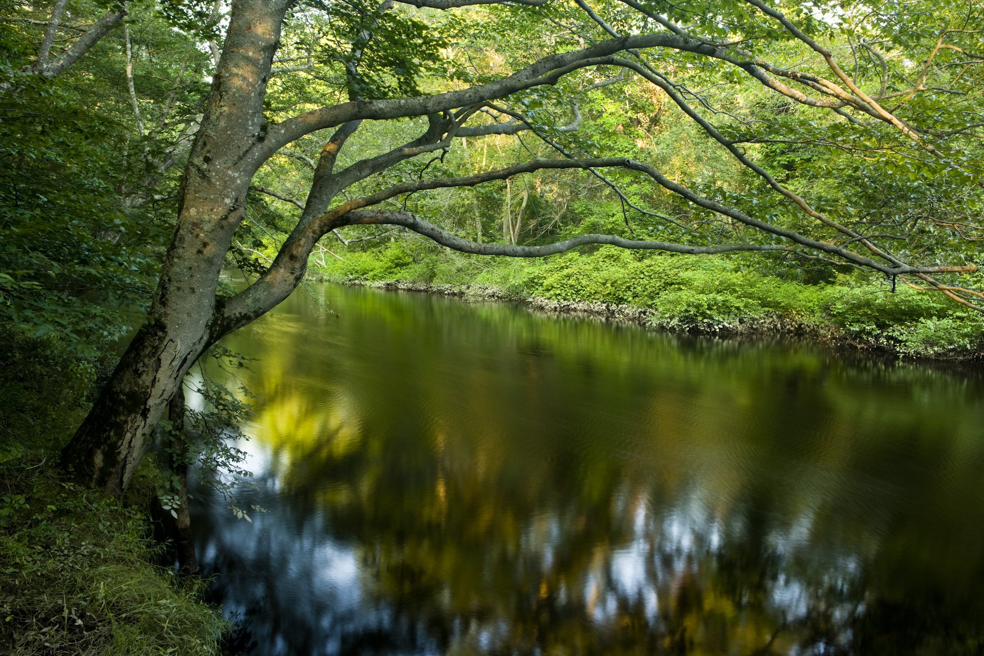
Great River Preserve in Bridgewater. Photo by Jerry Monkman.
By Skip Stuck, Key Volunteer
Throughout this "Human History of Wildlands" series, I've highlighted a wide range of ways that Native Americans, European settlers, and others have utilized and altered the Southeastern Massachusetts landscape, from clearing forests for farms to damming rivers for factories. Few parcels in our region have looked any one way for long. So, when Wildlands Trust undertakes responsibility for a new preserve, it often confronts a difficult question: Which version of the land’s history do we preserve or restore?
Great River Preserve in Bridgewater offers a unique example of a very different kind of history.
The preserve sits near the headwaters of the Taunton River. If you read our April 2024 history of the Taunton River watershed, you might remember that the retreat of the last glaciers around 12,000 years ago left this area covered in sandy soil and mud—not the rocks and boulders so prevalent elsewhere in Southeastern Massachusetts. Much later, the Taunton River's slow current would prove unsuitable for the hydropower generation that elsewhere fueled mills and factories. The land has thus continued to support high-quality forests and farms for generations.
Sachem Rock. Source: Sowams Early History
Early History
In 1647, a group of settlers known as the "Conihassett Partners" (derived from the Wampanoag name for a section of present-day Scituate) decided to expand their land holdings beyond the coast and obtained the first land grant for a large inland area. In 1649, at a place called Sachem Rock (close to today's Great River Preserve), the Wampanoag sachem Massasoit met with colonists including Miles Standish. There, Standish purchased 14 square miles of land that came to be known as Old Bridgewater. The purchase price included "7 coats, 9 hatchets, 8 hoes, 20 knives, 4 moose skins, and 10 and 1/2 yards of cotton." This is believed to be the first signed agreement in North America between the colonists and Native people.
Soon, colonists settled in the area, and Old Bridgewater split into four Bridgewaters—East, West, North (now Brockton), and Bridgewater proper. One of the earliest farms was Sachem Rock Farm in East Bridgewater, established in 1665. As the area grew, present-day Auburn Street became a main thoroughfare. In 1790, the Auburn Street Bridge, eventually known as the Covington Bridge, was built, connecting Bridgewater with Halifax to the east and Middleboro to the south. This bridge operated for over 200 years through multiple replacements and repairs until 1995, when it was finally dismantled.
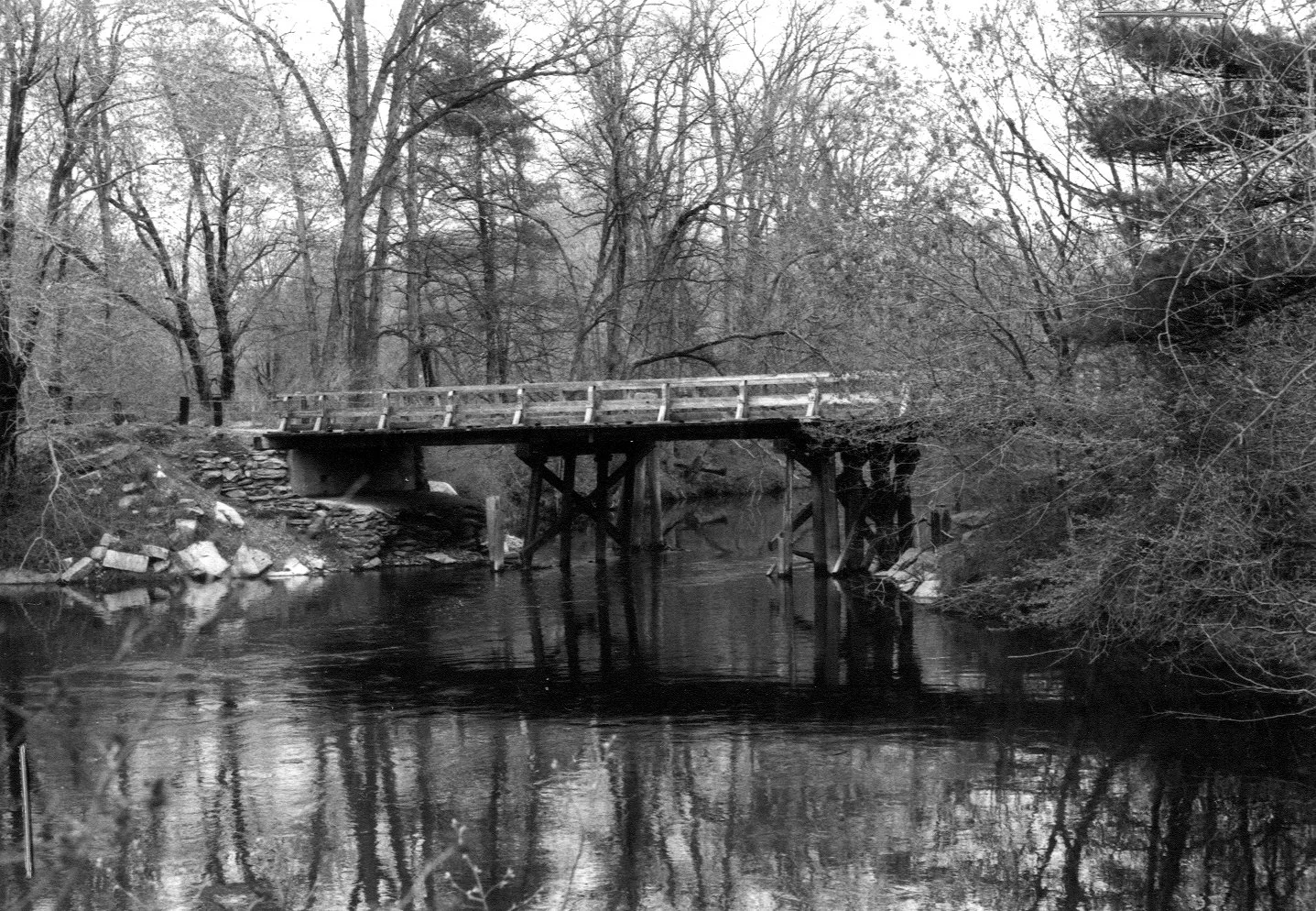
Auburn Street Bridge, 1981. Source: Recollecting Nemasket
In 1770, a Cape-style house that came to be known as the Leonard–Jackson House was built on a large farm on Auburn Street. This house has been in continuous use since, owned by the Leonard, Jackson, Brooks, and Belchunas families, among others, before ending up with the Lehtola family from 1945 to the present day.
From the late 1600s until the early 2000s, the land of Great River Preserve was in continuous use as a farm, pasturing cattle and horses and producing corn and hay. Unlike almost every other property in the region, this land likely looked in the 1700s much the same as it does today.
Protecting the Land
Owners Peter and Rita Lehtola were concerned that as they phased out farming activities, the land could be divided, developed, and changed forever. Then, Wildlands Trust Board Chair Howard Randall approached the Lehtolas with an idea of how it could be preserved. In 2008, the Lehtola family agreed to sell 230 acres of the property to MassWildlife and Wildlands Trust. Of those acres, 125 became Great River Preserve, while the remainder augmented MassWildlife’s Taunton River Wildlife Management Area, which today totals 349 acres. To make the agreement possible, Wildlands’ Board of Directors agreed to change a longstanding "no hunting" policy on their properties and allow hunting at Great River in a carefully regulated manner. This marked an important public-private collaboration, and a blueprint for future preservation efforts.
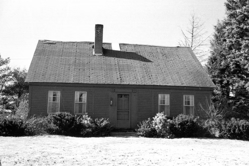
Leonard–Jackson House, 1984. Source: Bridgewater Archive
The protection project forever secured the future of a 1,400-acre open space corridor along 1.5 miles of the Taunton River. Since the acquisition, Wildlands has worked diligently to keep the fields hayed and forests healthy, so that the land’s character can persist at a time when farms of all kinds are going out of business and being swallowed up by development.
We hope you will visit Great River Preserve and seize the rare opportunity to see what farmers and settlers saw for 300 years.
A special thanks to the Lehtola family, without whose insights and recollections this piece would not have been possible. And as always, thanks to Thomas Patti, Wildlands’ Communications Coordinator.
Resources
“Leonard-Jackson House,” Bridgewater Archive. bridgewaterarchive.com/locations/houses/13
“Sachem’s Rock where Ousamequin traded with Myles Standish for Satucket lands in 1649.” Sowam’s Early History. sowamsearlyhistory.org/sachems-rock-where-osamequin-traded-with-myles-standish-for-satucket-lands-in-1649/
“Auburn Street Bridge,” Recollecting Nemasket. nemasket.blogspot.com/2013/03/auburn-street-bridge.html
East Bridgewater Library: eastbridgewaterlibrary.org
“Human History of Wildlands: The Taunton River Watershed," Wildlands Trust.
“Taking the Long Way Around,” John Stilgoe, Boston Globe. March 14, 2004.
Interview with Peter Lehtola, March 26, 2026.
Staff Picks: Where to Explore This Fall
If the arrival of September in Southeastern Massachusetts has you dreaming of brisk mornings, cozy sweaters, and leaves crunching underfoot, you’re not alone. We at Wildlands Trust are already planning our autumn hikes, paddles, rides, and picnics.
Are you looking for new places to explore this fall? Our staff and volunteers have you covered! Read on for a selection of our favorite autumnal landscapes, where you just might find us leaf peeping, migratory bird watching, or spooky story telling this season.
A note on safety: hunting season begins in the fall, so please take care to protect yourself, your loved ones, and your pets while on the trails. Consult our hunting safety guidelines before you head out. (Spoiler alert: wear blaze orange!)
Happy fall from all of us at Wildlands! Please share your fall nature photos with us at communications@wildlandstrust.org. Explore our trails across Southeastern Massachusetts at wildlandstrust.org/trails.
Hoyt-Hall Preserve, Marshfield
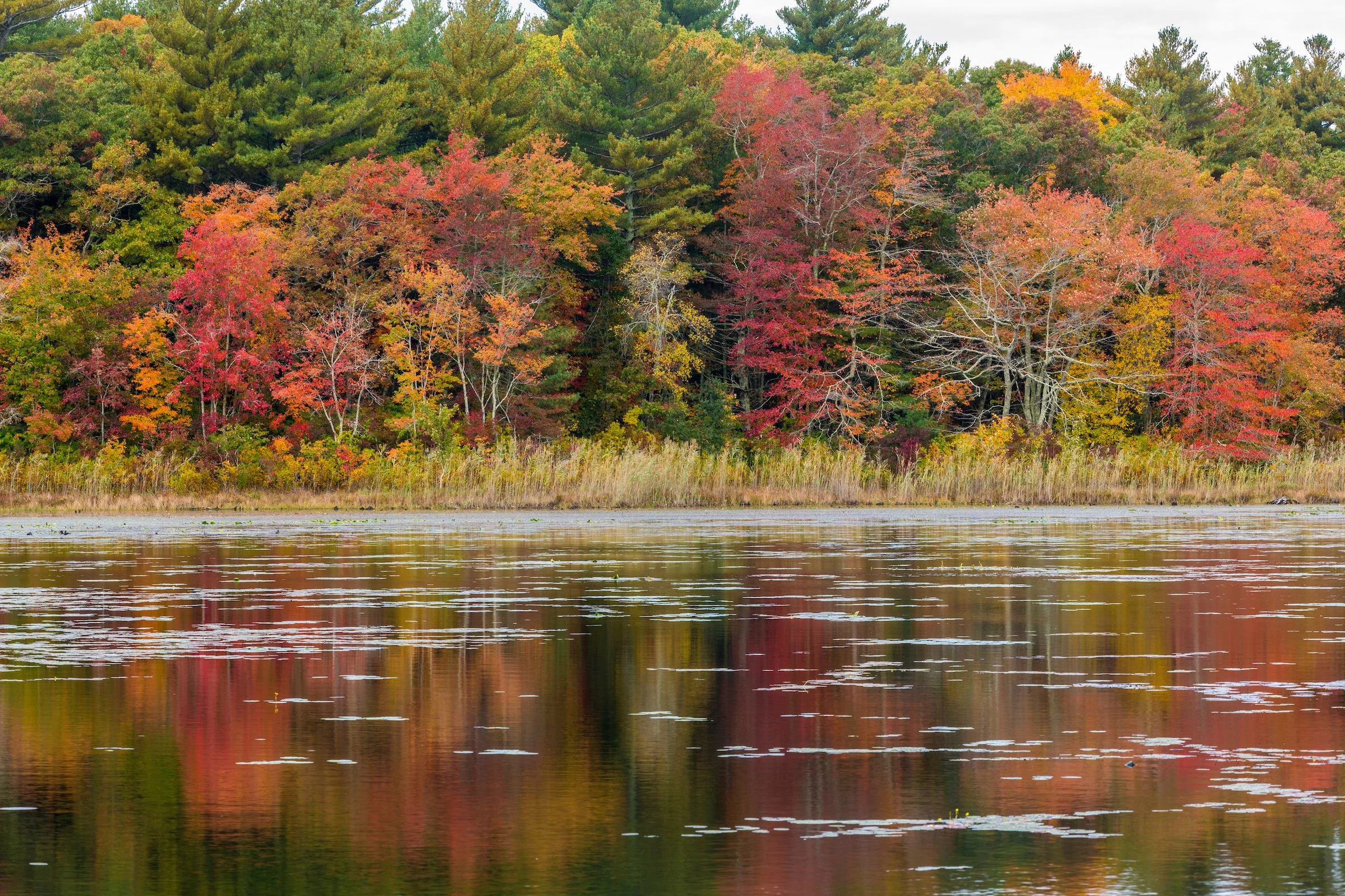
Photo by Jerry Monkman.
Trail map & property description: click here.
Rachel Bruce, Chief of Staff: The many deciduous trees show off their fall colors around Long Tom Pond, and a two-mile hike is perfect for a fall afternoon.
Tess Goldmann, Land Protection Assistant: I really enjoy Hoyt-Hall for its beautiful views of Long Tom Pond and its variety of different ecosystems you get to walk through. Plus, you can see all the red maples changing colors in October.
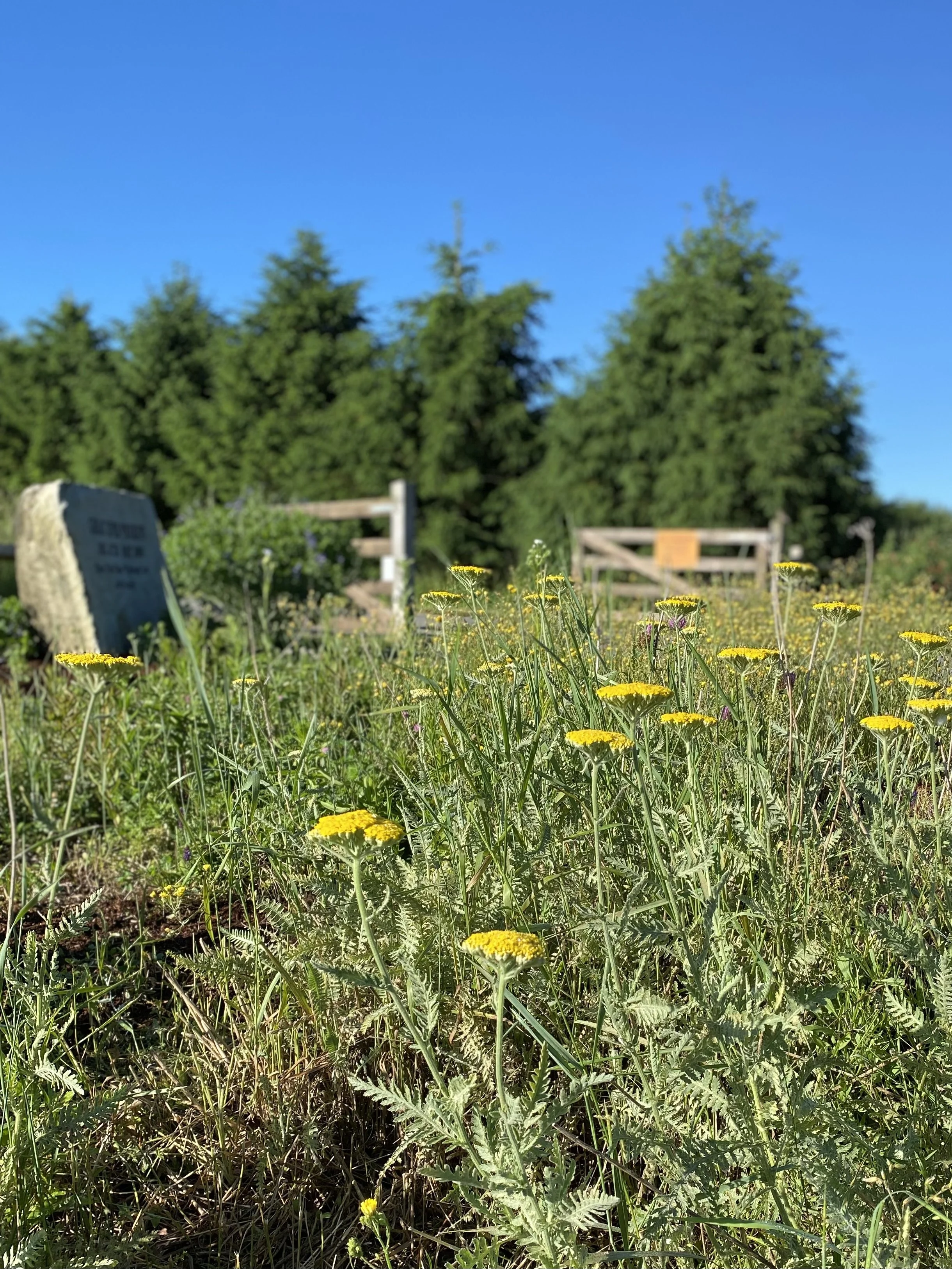
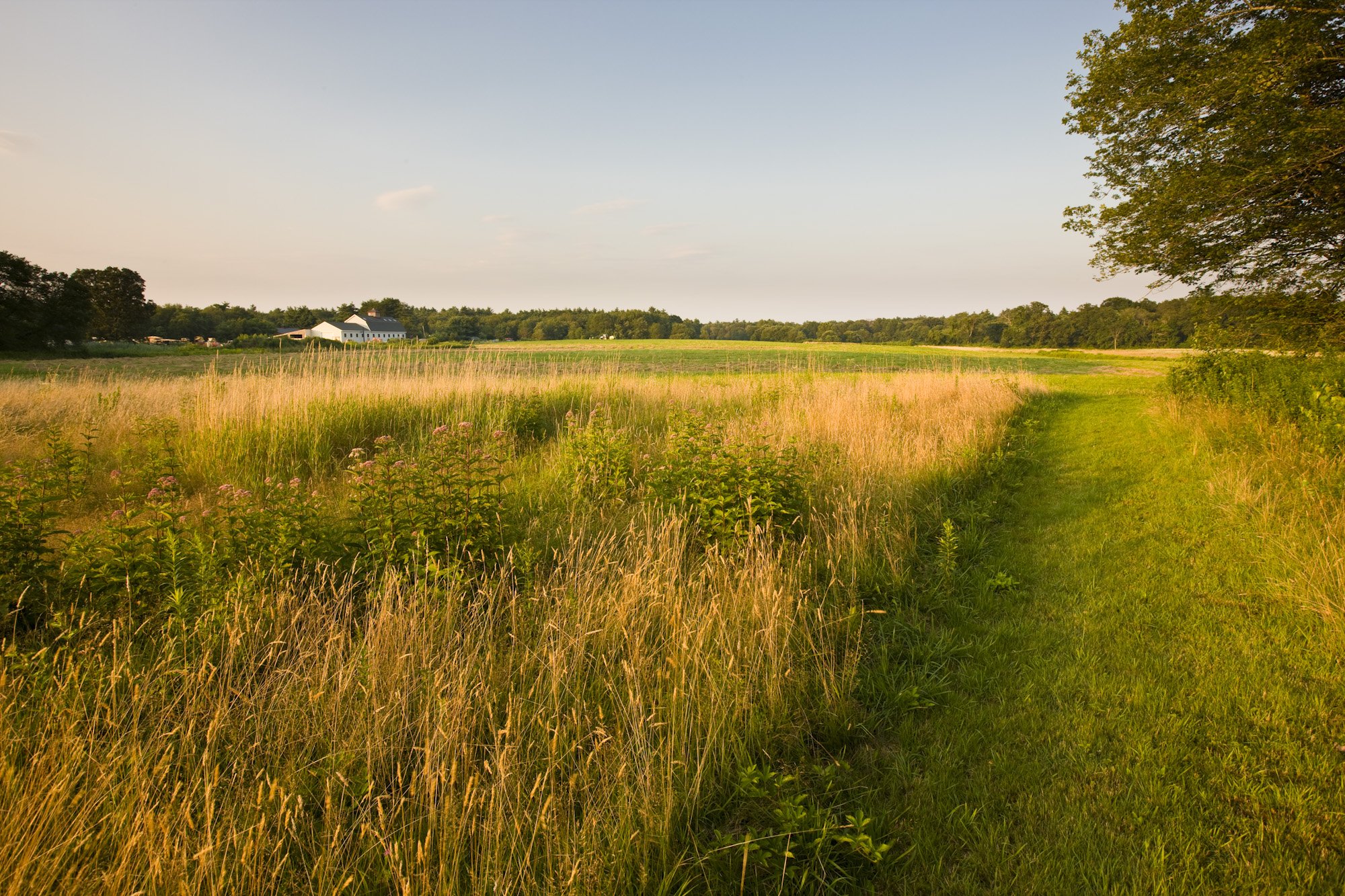
Great River Preserve, Bridgewater
Photo by Jerry Monkman.
Trail map & property description: click here.
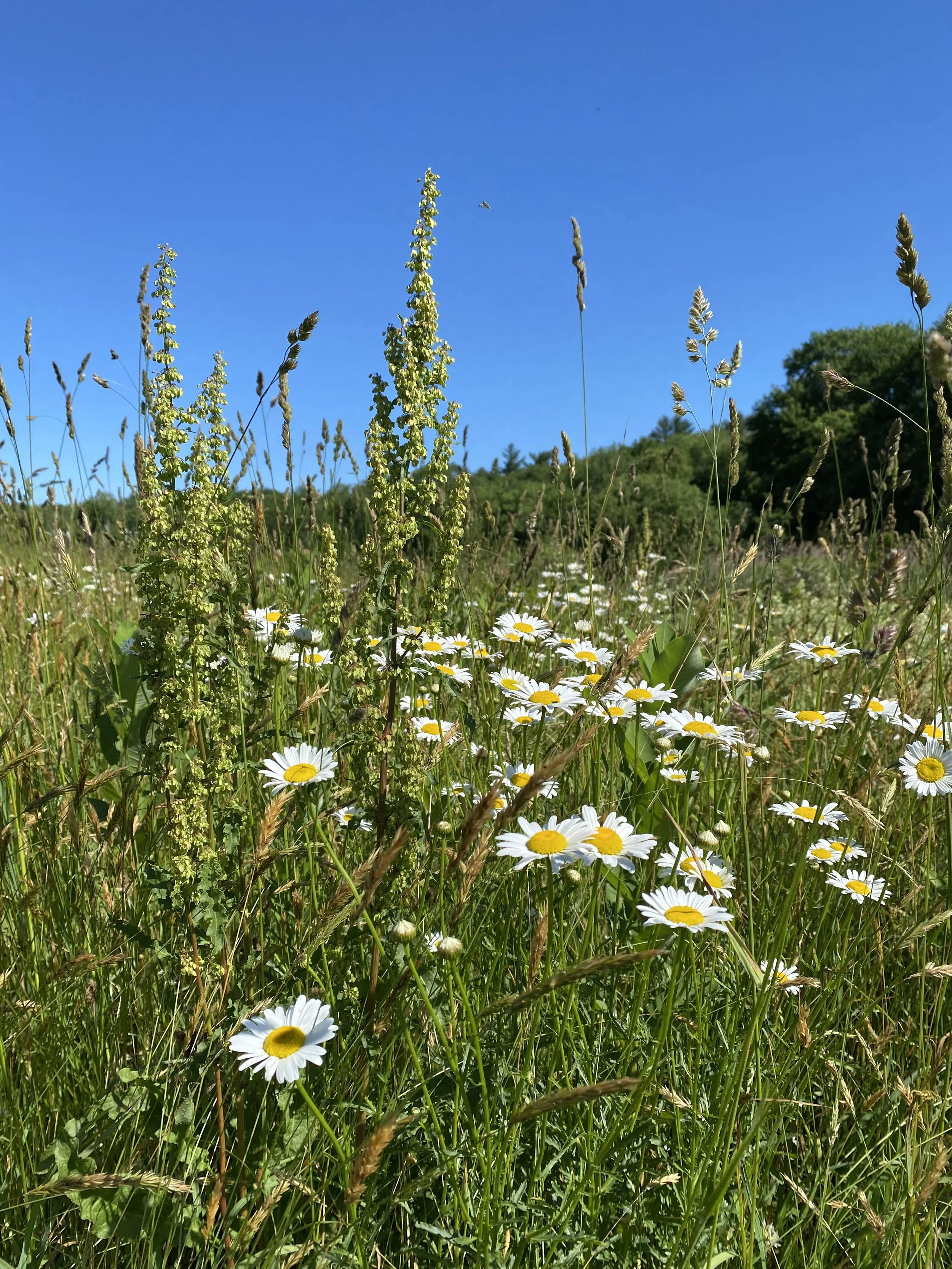
Marilynn Atterbury, Key Volunteer: As the leaves begin to turn, there’s no place I’d rather be than Great River Preserve. In the fall, the landscape transforms into a landscape of color. The meadows are dotted with Joe-Pye weed, jewel plants, and goldenrod, creating a stunning display. The meadows also become a haven for monarch butterflies, which lay their eggs on the milkweed that thrives there. Meanwhile, the maples and oaks along the Taunton River put on a breathtaking show of scarlet and gold. It’s this vibrant tapestry of nature that makes Great River Preserve my favorite fall destination.
Scott MacFaden, Director of Land Protection: The Great River Preserve is a fall favorite of mine. While it shines at any time of year, it is particularly luminous in autumn because of its juxtaposition of open fields, woods, and the Taunton River. I like to leisurely hike along the edge of the fields before spending some time at the viewing platform overlooking the river—one of the most peaceful and contemplative locations in all of Southeastern Massachusetts.
Indian Head River Trail – Pembroke, Hanover, Hanson

Photo by Andrew Lederman.
Trail map & property description: click here.
Amy Burt, Programming Coordinator: My favorite preserve is the Indian Head River Trail, a four-mile loop that encompasses Wildlands' Tucker Preserve. This time of year, you can get a great view of the river with the leaves falling while walking down a cathedral of color. Year-round, I enjoy channeling my inner goat and climbing the rocks.
Great Neck Conservation Area, Wareham

Photo by Rob MacDonald.
Trail map & property description: click here.
Skip Stuck, Key Volunteer: I like Great Neck because it has a little of everything. Uplands, ocean, marshlands, a pond full of waterfowl in the fall, and vernal pools surrounded by red swamp maples.
Kyla Isakson, Membership Manager: I love the diversity of the landscapes at Great Neck. You get a little bit of everything: ponds, farmland, pine forests, and ocean views. An underrated showcase preserve that is great year-round.
Wyman North Fork Conservation Area, Bridgewater

Photo by Rob MacDonald.
Trail map & property description: click here.
Thomas Patti, Communications Coordinator: As one of our newest public preserves, Wyman North Fork Conservation Area (a partnership between Wildlands and the Town of Bridgewater) remains a hidden gem… for now. This fall, visitors will hear bluebirds and goldfinches rustling in the meadow’s native grasses and gaze at the secluded woodlands’ vibrant foliage, hanging from the branches and reflecting off the glassy surface of the Taunton River.
Human History of Wildlands: The Taunton River Watershed
When I started researching the history of Wildlands Trust’s Great River Preserve in Bridgewater, it occurred to me that there was a different kind of story here, not just of one preserve, but of an entire region—namely, the Taunton River watershed. Here, I take a broader look at this 500-square-mile area, one within which Wildlands Trust and its partners protect a variety of landscapes that are important as individual parcels but carry even greater significance in the context of their shared history.

Striar Snake River Preserve in Taunton. A project is underway to improve public access at this preserve.
By Skip Stuck, Key Volunteer
Those of you who have been following our "Human History of Wildlands" series know that the approach so far has been to tackle one preserve or one community at a time and to dig as deeply into that story as historical resources allow. However, when I started researching the history of Wildlands Trust’s Great River Preserve in Bridgewater, it occurred to me that there was a different kind of story here, not just of one preserve, but of an entire region—namely, the Taunton River watershed. Here, I take a broader look at this 500-square-mile area, one within which Wildlands Trust and its partners protect a variety of landscapes that are important as individual parcels but carry even greater significance in the context of their shared history. In upcoming entries to this series, we will zoom back in to the stories of individual preserves in the watershed, like Great River Preserve, Striar Conservancy in Halifax, and Wyman North Fork Conservation Area in Bridgewater. Today, we will take this broader view.
A watershed is a land area within which all rainfall and snowmelt funnels into the same place. A raindrop in Foxborough, even if it’s 15 miles from the headwaters of the Taunton River, will eventually work its way down smaller streams or in groundwater to the Taunton and empty into Mount Hope Bay and the Atlantic Ocean. So, the point where that raindrop first splashed down in Foxborough is part of the Taunton River watershed.
The map below will help convey the size of the Taunton River watershed and its importance to Wildlands’ work. Of the 57 cities and towns that Wildlands Trust serves, 30 lie at least partially within the Taunton River watershed, which encompasses 562 square miles across Southeastern Massachusetts. Wildlands protects over 2,150 acres of land in the Taunton River watershed through outright ownership, Conservation Restrictions, and deed restrictions.

The Taunton River watershed is home to geographical and historical features that exist nowhere else in Massachusetts. It features the longest undammed coastal waterway in the state. This is in part because it drops only 20 feet from its source in Bridgewater to its mouth in Fall River, curbing its power generation potential. The Taunton River is tidal up to the City of Taunton, meaning it contains salt and brackish water for about half of its length.
The watershed is home to over 500,000 people across 43 towns and cities, covering portions of three counties. Despite the dense settlement around it, the Taunton River is a federally designated Wild and Scenic River. The region is also home to the largest freshwater swamp in southern New England, the nearly 17,000-acre Hockomock Swamp.
These features and many others play important roles in the area's human history. Now, let’s move back in time.
Pre-history
As the glaciers receded between 12,000 and 13,000 years ago, they left a landscape scraped and scoured, with piles of rocks, rubble, moraines, eskers, and other geological features. Across central Southeastern Massachusetts, a large moraine created a debris dam that prevented melting glacial water from draining into the ocean. The result was Glacial Lake Taunton, which spanned 54 square miles and plunged 130 feet deep. The lake lasted for about 300 years before the dam broke.

Glacial Lake Taunton. From “Understanding Geological History when Selecting Trenchless Installation Methods” by Haley & Aldrich.
When the dam finally breached, the rushing water spread a mix of gravel and mud across the watershed area, building the foundation for some of the richest forests and farming soils in Southeastern Massachusetts. It also created today's Taunton River and its many tributaries.
People soon arrived. We know a good deal more about the pre-European history of the Taunton River watershed than of much of the rest of Southeastern Massachusetts. In fact, some of the oldest archeological evidence of human habitation in New England comes from digs, finds, and studies in Bridgewater, Middleborough, and the "Titicut" site, dating back more than 9,000 years. The watershed was heavily populated for the time. Several area names survive. Cohannet, Tetequet, Titiquet were all used by the resident Wampanoag Tribe to describe the river and its valley.
The flat, slow-flowing river also became a major route for Native Americans to trade and move seasonally to productive hunting and fishing areas. The 72-mile Wampanoag Canoe Passage was a well-traveled route that allowed relatively easy passage between Cape Cod Bay and Narragansett Bay via the North River and the Taunton River. The passage has been restored and cleared in some areas and can be followed today.
Along the route, Natives likely passed through the Hockomock Swamp, derived from "Hobomock," the deity tied to death and disease, but also to the spirits of ancestors. It was also an area favored as a sanctuary and for its rich game and hunting resources.
Great River Preserve in Taunton.
European Settlement
After 1620, the English settlers of the Plymouth Colony soon moved west and found that the Taunton River area held great promise. Good soil. Easy river travel. And while the main river's current was too slow to produce power for mills, tributaries such as the Town, Matfield, Winnetuxet, Nemasket, and Three Mile Rivers all tumbled into the valley with sufficient energy to provide waterpower and to support the largest spring runs of alewives and river herring in the state.
The watershed was initially part of the "Duxbury Purchase," but settlement soon created towns such as Taunton in 1637 and Bridgewater in 1645, and ultimately Plymouth and Bristol Counties. Farms thrived upriver, while ironworks and shipbuilding made Taunton a growing city. Eventually, Taunton earned the name "the Silver City" due to its reputation for silversmithing and jewelry making.
As with nearly all of Southeastern Massachusetts, and much of New England, this prosperity was not to continue without setbacks. The most notorious one was King Phillip's War from 1675 to 1676. Initially good relations between European colonists and the Wampanoag Tribe and its chief Massasoit, crucial to the Plymouth Colony's early survival, had in two generations deteriorated into war. The Tribe, led by Massasoit's son Metacomet (who chose the name King Philip), was feeling taken advantage of by the colonists. A revolt ensued, and the Taunton River area, especially Hockomock Swamp, was its epicenter. While the hostilities eventually reached all of New England and upstate New York, the Plymouth Colony and adjacent Rhode Island bore the brunt of the fighting. Whereas the colonists feared and avoided the swamp, the Natives found safety and sanctuary there. In fact, the war only ended when the colonists finally entered the swamp and routed Metacomet and his people. In the end, King Phillip's War was the costliest in terms of property destruction and death—to both colonists and Natives—in all of colonial America.

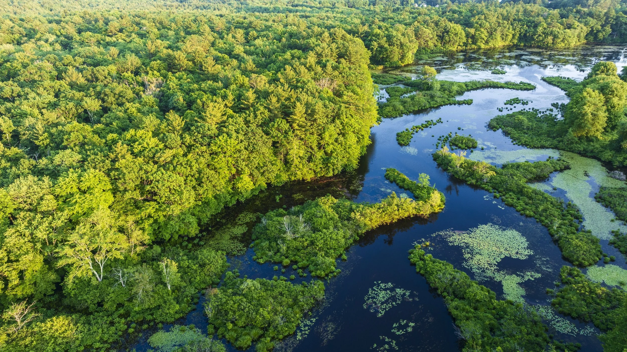
The Taunton River passes through the forests of Wyman North Fork Conservation Area in Bridgewater. In 2024, Wildlands acquired an additional 90 acres directly across the river from Wyman North Fork, further protecting this section of the Taunton River corridor less than two miles from its headwaters.
After the war, colonial prosperity resumed, and towns grew and flourished. Many attempts to drain Hockomock Swamp ensued, but each ultimately failed. The swamp served as a natural "sponge," absorbing water and preventing the kinds of floods that periodically disrupted life on many nearby rivers. Indeed, failures to drain the swamp substantially contributed to the Taunton River’s wild and pristine state today. Similarly, the Taunton’s incapacity for waterpower has benefited the watershed’s ecological health, as it kept the river undammed, free-running, and surrounded by forest and farmland. Thanks to its unique natural characteristics that stifled colonial industrialism, the Taunton River is now a federally designated National Wild and Scenic River.
Today, the Taunton River watershed is home to many wonderful nature preserves. Wildlands Trust, MassWildlife, the Taunton River Watershed Alliance, and its cities and towns work together to protect this special place. Great River Preserve, Wyman North Fork Conservation Area, Striar Conservancy, Brockton Audubon Preserve, and soon Striar Snake River Preserve in Taunton are some of the Wildlands properties where you can see the results for yourself.
To learn more, please see our website at wildlandstrust.org and visit some of our preserves in the Taunton River watershed.

Striar Conservancy in Halifax is located on the bank of the Winnetuxet River, a tributary of the Taunton River.
Learn More
Resources for this article include:
The Taunton River Watershed Alliance: savethetaunton.org
Tetiquet To The Sea: A History of the Taunton River: oldcolonyhistorymuseum.org/product/tetiquet-to-the-sea
Wild and Scenic Taunton River: srpedd.org/environment/wild-and-scenic-taunton-river
Archaeology of Dighton: plymoutharch.tripod.com/id157.html
Understanding Geological History When Selecting Trenchless Installation Methods: haleyaldrich.com/wp-content/uploads/2020/08/NETA
The Wampanoag Canoe Passage: North and South River Watershed Association, "River Watch," April 2015.
Thanks to Thomas Patti for his editing and encouragement, to Owen Grey for his mapping assistance, and to Tess Goldmann for her analysis of Wildlands’ holdings in the Taunton River watershed.
If you have photographs, historical documents, or maps related to the history of the Taunton River watershed, we want to see them! Please send any information to communications@wildlandstrust.org.
Hunting Season Safety
Updated: October 2024
Hunting season is back upon us this fall in Massachusetts! Wildlands Trust has four properties that permit hunting during this time:
Barnes Rymut Preserve, Halifax

Hunting is prohibited on all other Wildlands Trust properties.
Still, boundaries can be confusing and hunters sometimes cross into prohibited areas unknowingly. Please be mindful when you are out in the woods this year, wherever it is that you like to hike, run, or ride. The best way to protect yourself is to wear blaze orange like our staff does!
While hunters are required to wear blaze orange during certain seasons, Mass Wildlife recommends that all outdoor users who are in the woods during hunting season wear blaze orange clothing as a precaution, and that pets wear an orange vest or bandana for visibility.
You can learn more at mass.gov/topics/hunting.
Have a great fall, and stay safe!
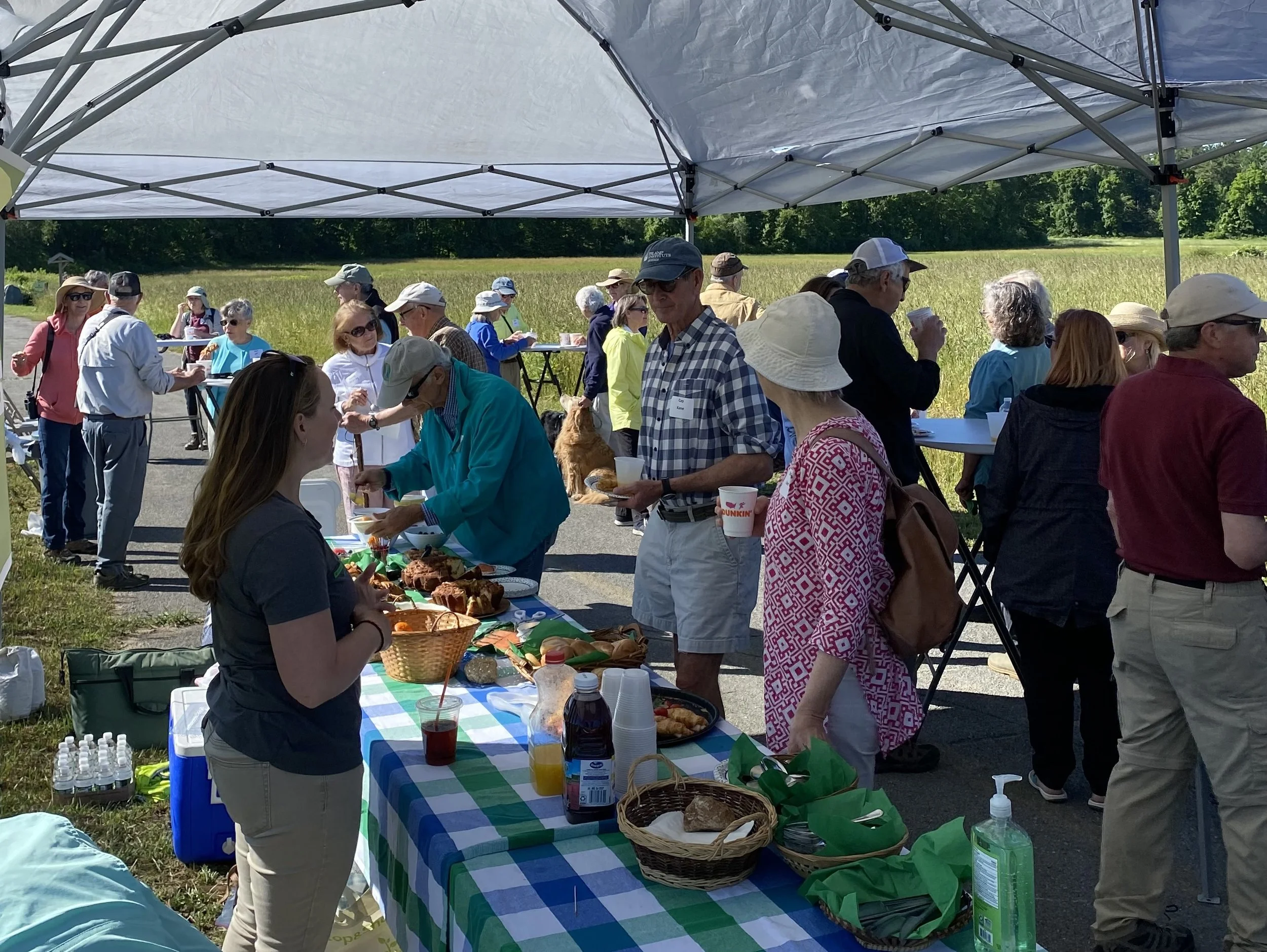
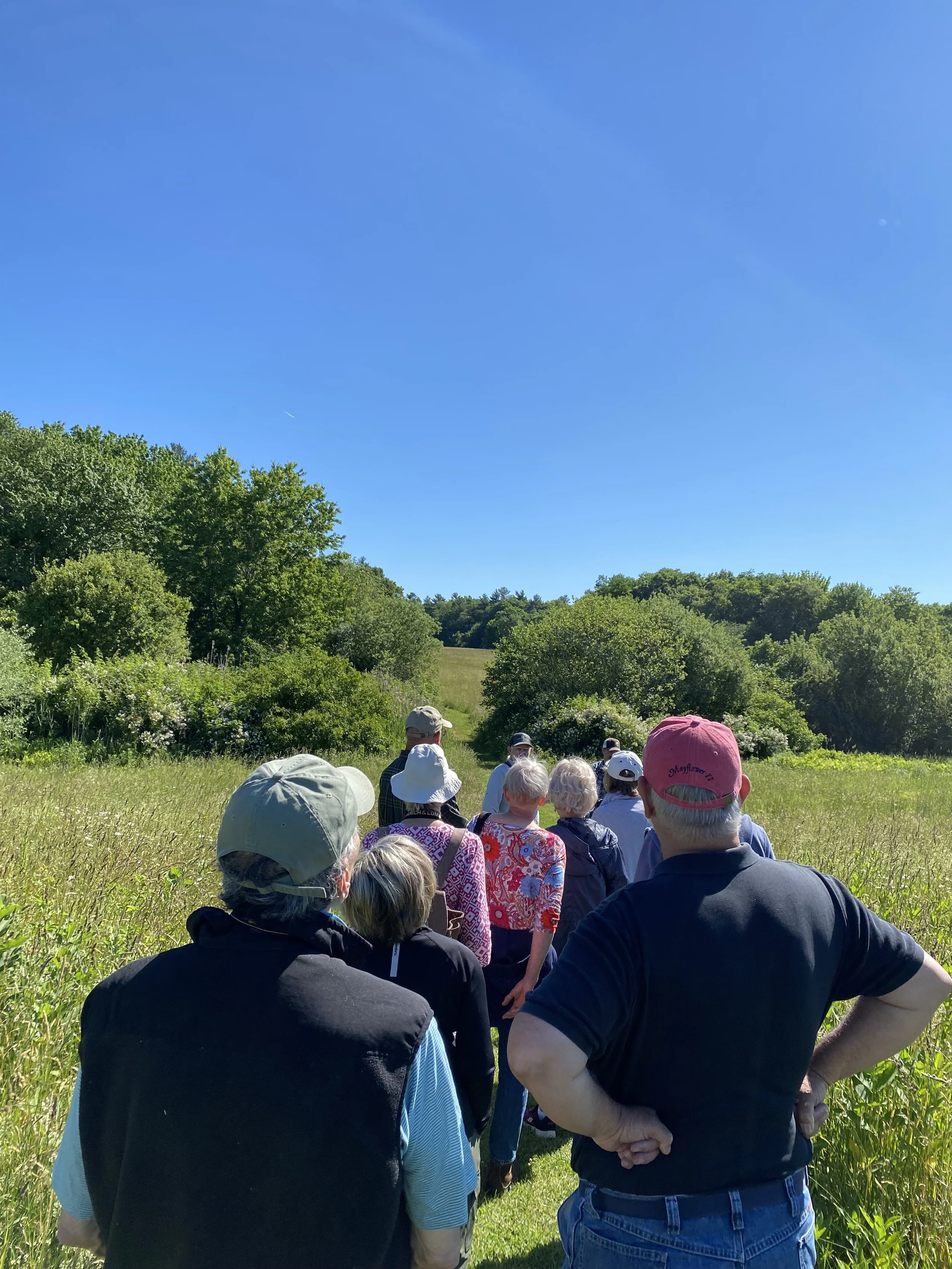
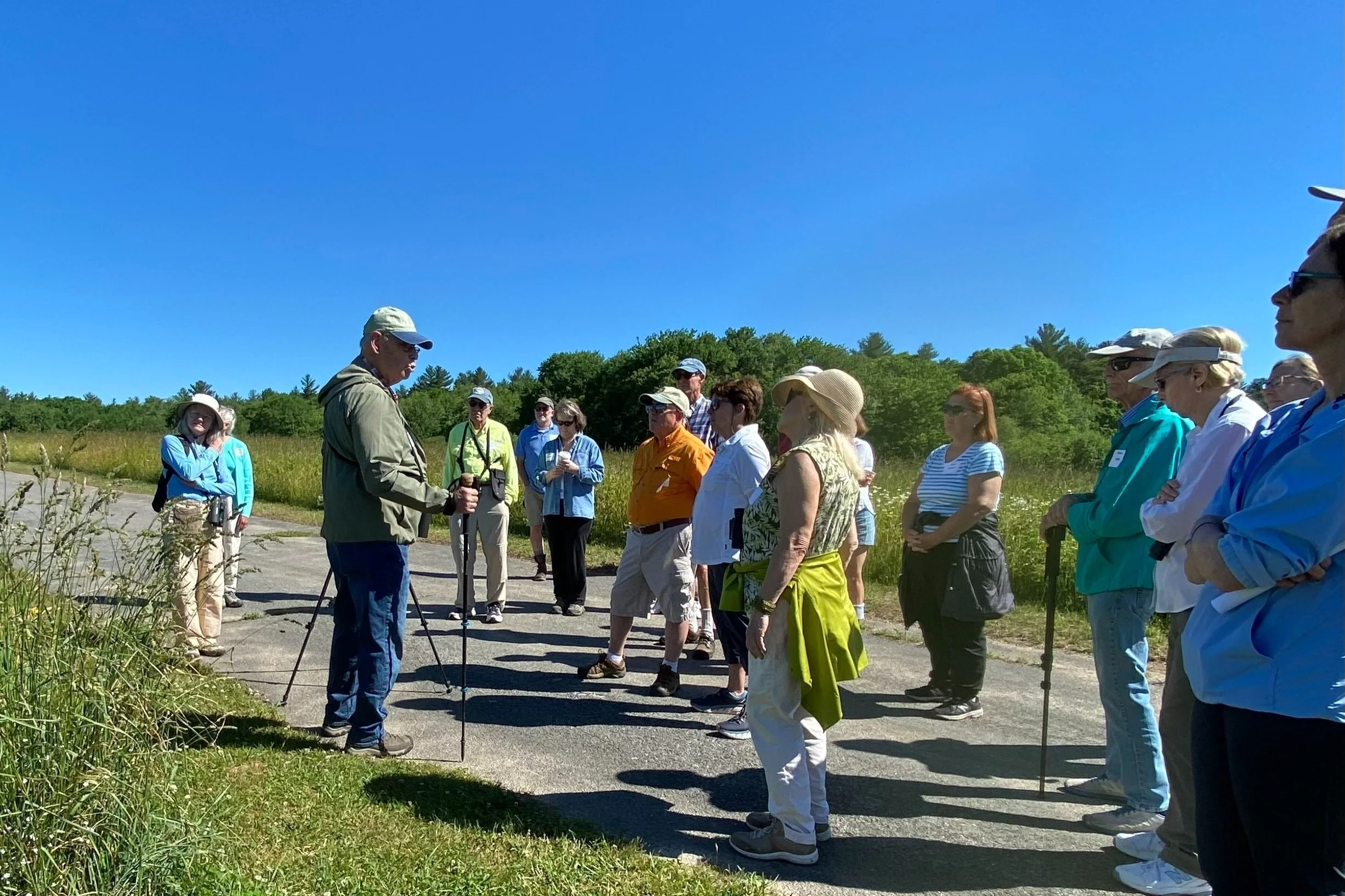
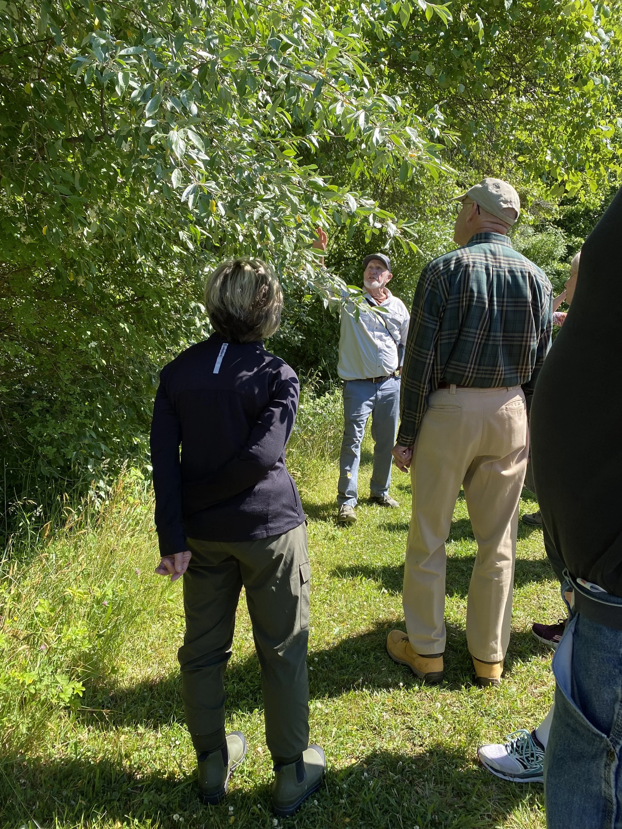
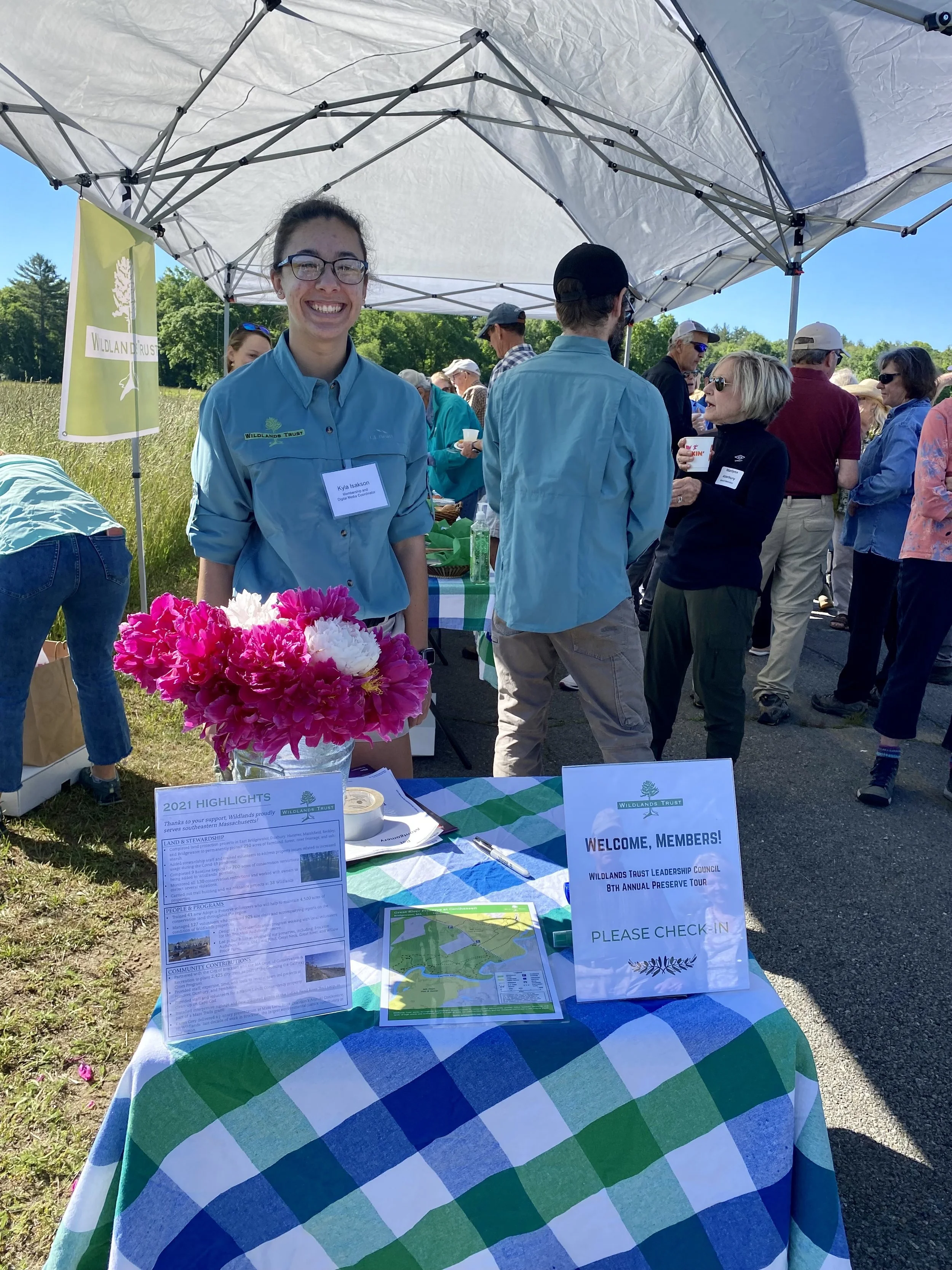
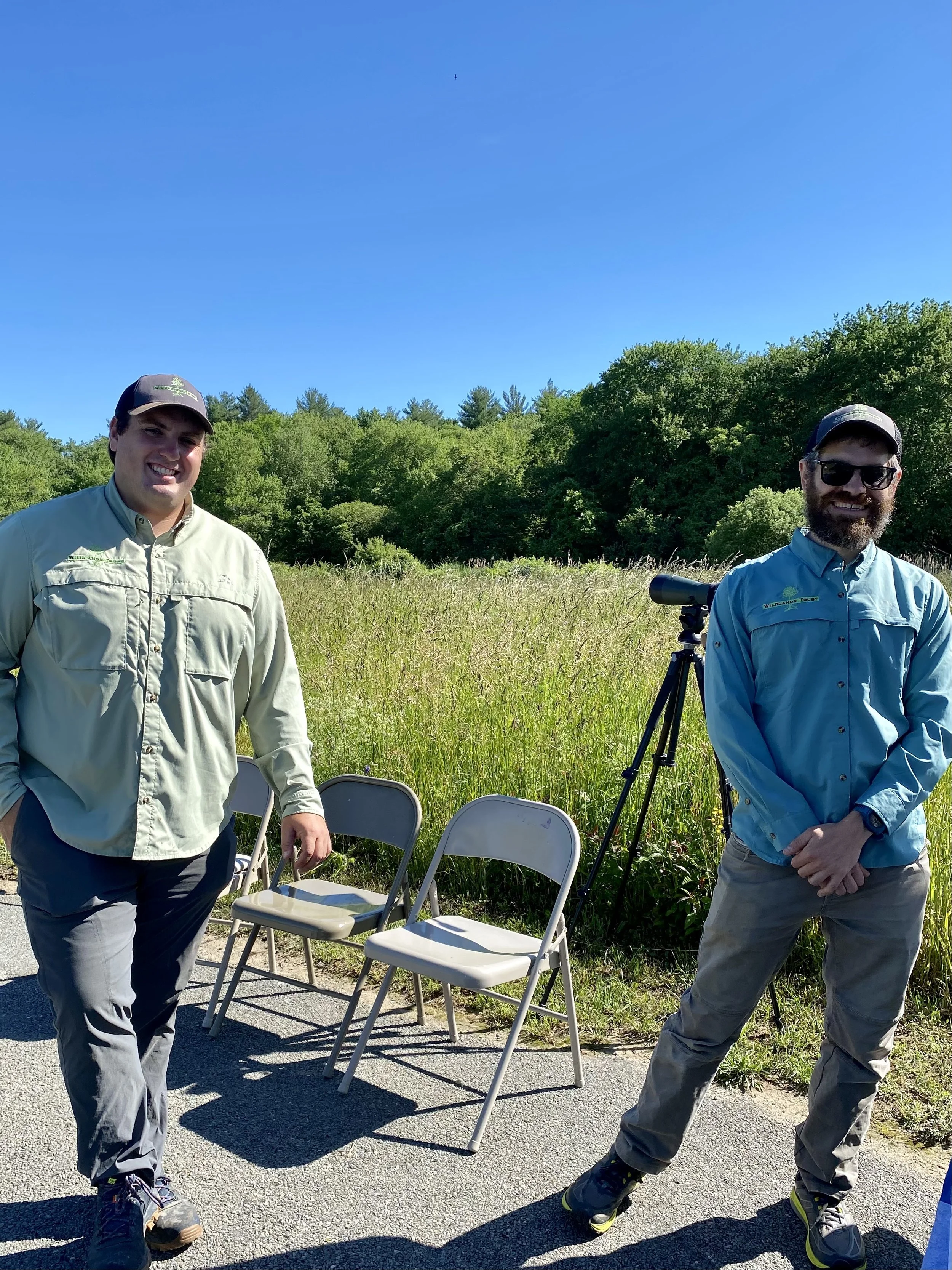
Leadership Council Honored at Annual Preserve Tour
Read Time: 2 min
By Kyla Isakson, Membership and Digital Media Coordinator
The Leadership Council’s 8th Annual Preserve Tour took place on Friday, June 10. Over 40 members convened with Wildlands’ staff at the entrance of Great River Preserve, in Bridgewater, for a reception to honor the group of donors who contributed major gifts this year. They received a warm welcome from Chairman of the Board Sam Chapin and Executive Director Karen Grey, detailing the importance of the group’s dedication to our organization and the value of the unique lands we conserve.
After a wonderful breakfast, Wildlands’ Board Members and avid birders Brian Harrington and Wayne Petersen each led a portion of the attendants on a walk through the preserve. Time was spent embracing the valuable diversity of the surrounding land and wildlife, observing American Robins, Great Blue Herons, Yellow Warblers, Bobolinks, Grackles, Baltimore Orioles, dragonflies, and American toads, just to name a few! Our knowledgeable guides shared tips for identifying different bird species based on both appearance and vocalizations. Wildlands Trust is incredibly grateful to all of our Leadership Council members for the significant and important support they provide for land conservation throughout the year!