What’s New at Wildlands
From Farmland to Grassland
How Wildlands’ management of former farmlands provides a reliable habitat for pollinators and other wildlife throughout the South Shore.
By Membership & Communications Manager, Roxey Lay
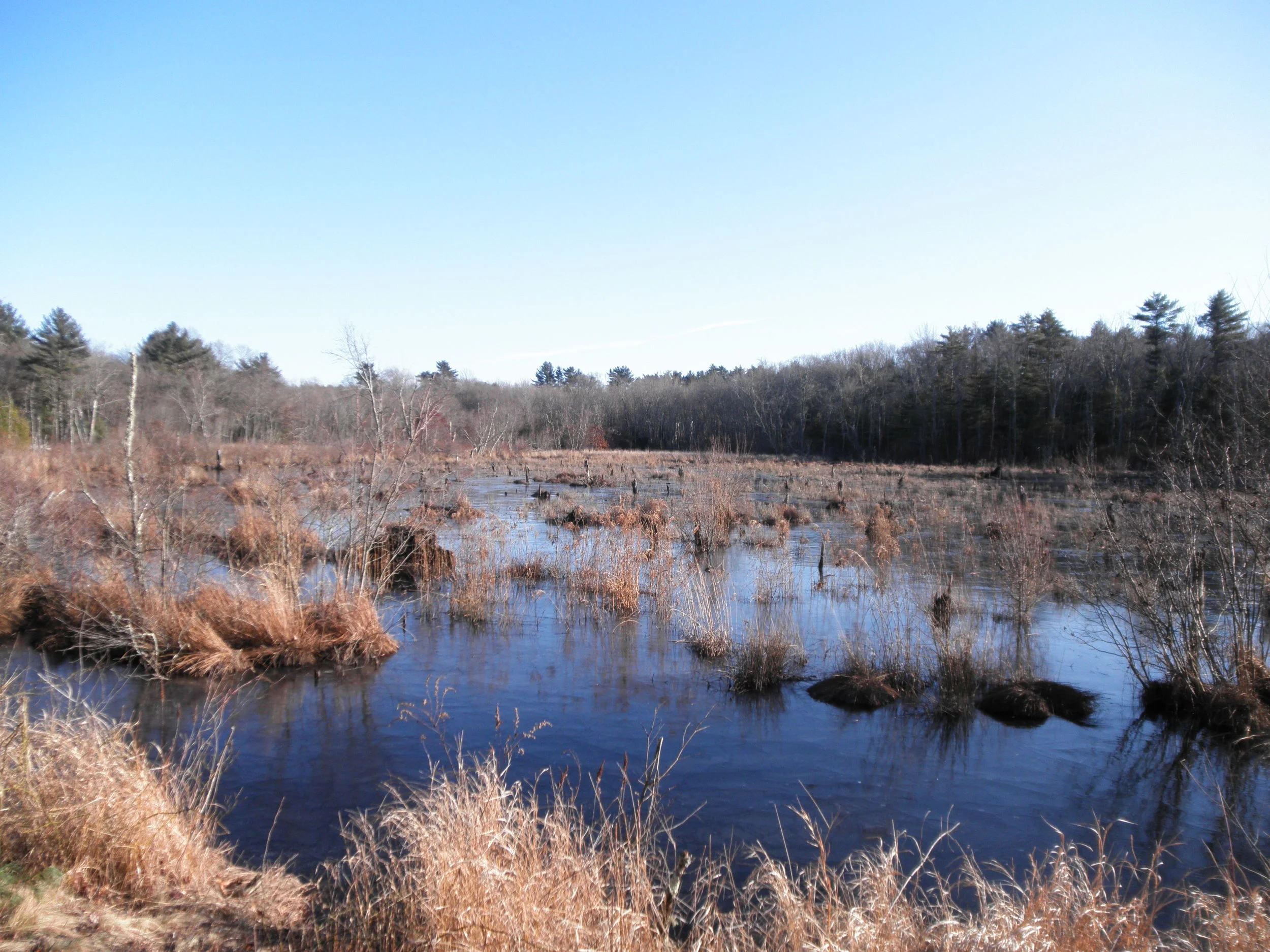
When you think of a Wildlands Trust preserve, you may immediately think of trails that lead visitors throughout woodlands to explore the undeveloped pockets of the region. What you may not think of immediately are fields. In addition to the wooded areas Wildlands protects, there are also a number of former farms, managed by stewardship staff to remain as open grasslands. Habitats like these fields tend to disappear in this part of the state, either through development, the installation of solar fields, or through lack of management. “Grasslands don’t want to stay grasslands”, Stewardship Manager, Erik Boyer explains. “Their natural state is forest.” With fewer grassland habitats throughout the region, Wildlands makes it a point to maintain a number of properties like Great River Preserve, Willow Brook Farm Preserve, and Phillips Farm Preserve, as such in order to provide a stable habitat and foraging area for wildlife that rely on vegetation that grows there.
Joe-pye weed, Eutrochium purpureum, grows at Great River Preserve in Bridgewater.
A primary group that rely on these areas are pollinators, like bees. Throughout North America, there are nearly 4,000 native species of bees [1]; however, 14 species in New England are on the decline by as much as 90% [2]. This does not include the European honey bee, which is not native to North America, having been brought over in the 1600s by the colonists. In an attempt to pinpoint the cause of this decline, “scientists have blamed a range of factors including insecticides (neonicotinoids), parasites, disease, climate change and lack of a diverse food supply” [2]. Native flower diversity is a critical part in helping the region’s native bee species as well as having various plants that bloom during different months throughout the year. “Having large open fields that have native plants that provide a continuous food supply to common and specialty bees are important”, explains Plymouth County Entomologist, Blake Dinius. “Many types of bees only forage during certain months out of the year.” A large number of common plants that attract generalist foragers like honey bees and bumble bees aren’t always adequate for specialist species who only feed on specific flowers; if those types of plants aren’t available, these species die off.
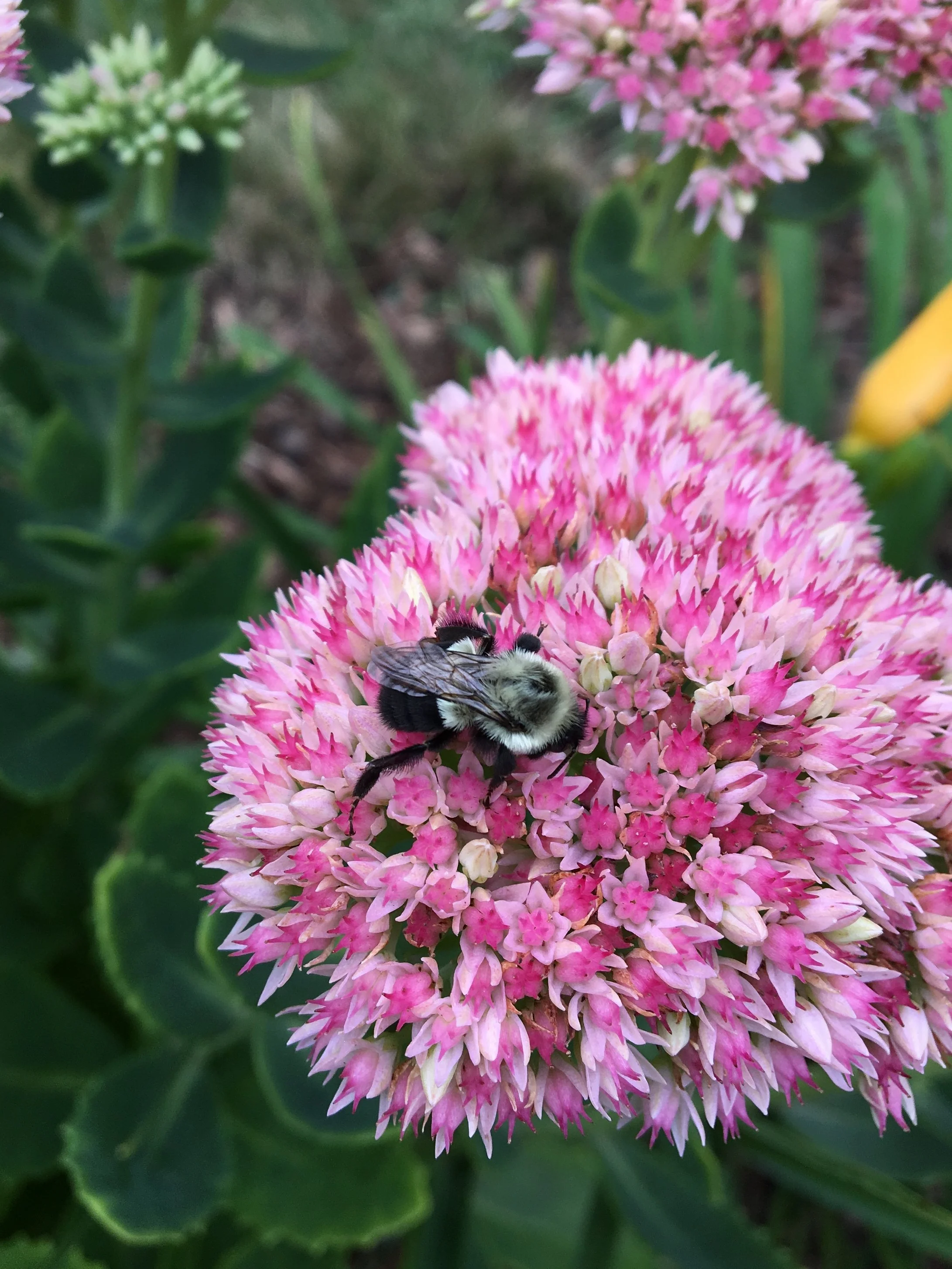
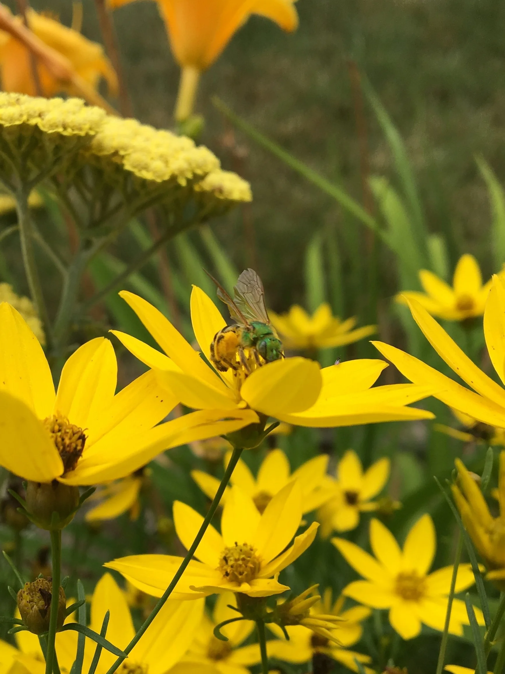

The distance between foraging sites is important as well. “Bees and other insect pollinators require nesting sites (suitable soil, dead wood, abandoned mouse nests, burrows) and floral resources (nectar and pollen) to persist” [3]. Unlike the honey bee, which lives in a hive, 70% of all bees nest underground [4] and viable nesting and foraging sites like open grasslands are at risk due to “row-crop agriculture, grazing and fragmentation of habitat” [3]. While larger species like honey bees and bumble bees travel 2-3 miles (sometimes farther) outside of their nesting location for food, many solitary bees, who are smaller yet “known to pollinate plants more efficiently than honey bees” [5], travel very short distances (typically less than a mile). Maintaining sites that are relatively close together are important in supporting the wide range of needs among various species.
Habitat loss and fragmentation, the process of reducing large tracts of land into smaller pieces via development, “are currently the main threats to terrestrial biodiversity”[6]. Wildlands works to expand continuous areas of ecological significance when acquiring land by identifying parcels that share borders with properties protected by towns and other organizations. This type of collaboration results in the creation of larger wildlife corridors throughout various habitats. Willow Brook Farm in Pembroke is a prime example of this. The roughly 167 acres that compose Willow Brook are nestled between Herring Run Historical Park and Misty Meadows Conservation Area. The shared borders between these three conservation lands results in a much larger protected area and reduces the distance between open spaces.
In short, Wildlands’ preserves which contain managed open fields provide food, a safe place to nest and a pesticide free environment for pollinators and other wildlife who rely on them. While there is much to learn in regards to why bees are facing declining numbers, there’s no doubt these spaces play an important role in their survival and the overall environmental health of the region. Through the preservation of varied habitats that include these grasslands, Wildlands and other land conservation organizations are working together to secure expansive tracts of vital habitat that may otherwise be lost forever.
A map showing the shared borders of Misty Meadow Conservation Area, Willow Brook Farm Preserve and Herring Run Historical Park.
[1] https://www.popsci.com/science/article/2013-06/10-spectacular-native-bees/
[2] https://www.apnews.com/f768748b36c648e49c14b0366fdec7e8
[3] https://www.nap.edu/read/11761/chapter/5#93
[4] https://entomology.cals.cornell.edu/extension/wild-pollinators/native-bees-your-backyard/
[5] https://www.growwilduk.com/wildflowers/bees-pollinators/take-crash-course-solitary-bees
[6] https://www.sciencedirect.com/topics/earth-and-planetary-sciences/habitat-fragmentation
What's Up With Wetlands?
By Roxey Lay, Membership and Communications Coordinator
EPA map displaying coastal wetlands and how far inland they extend (click to enlarge).
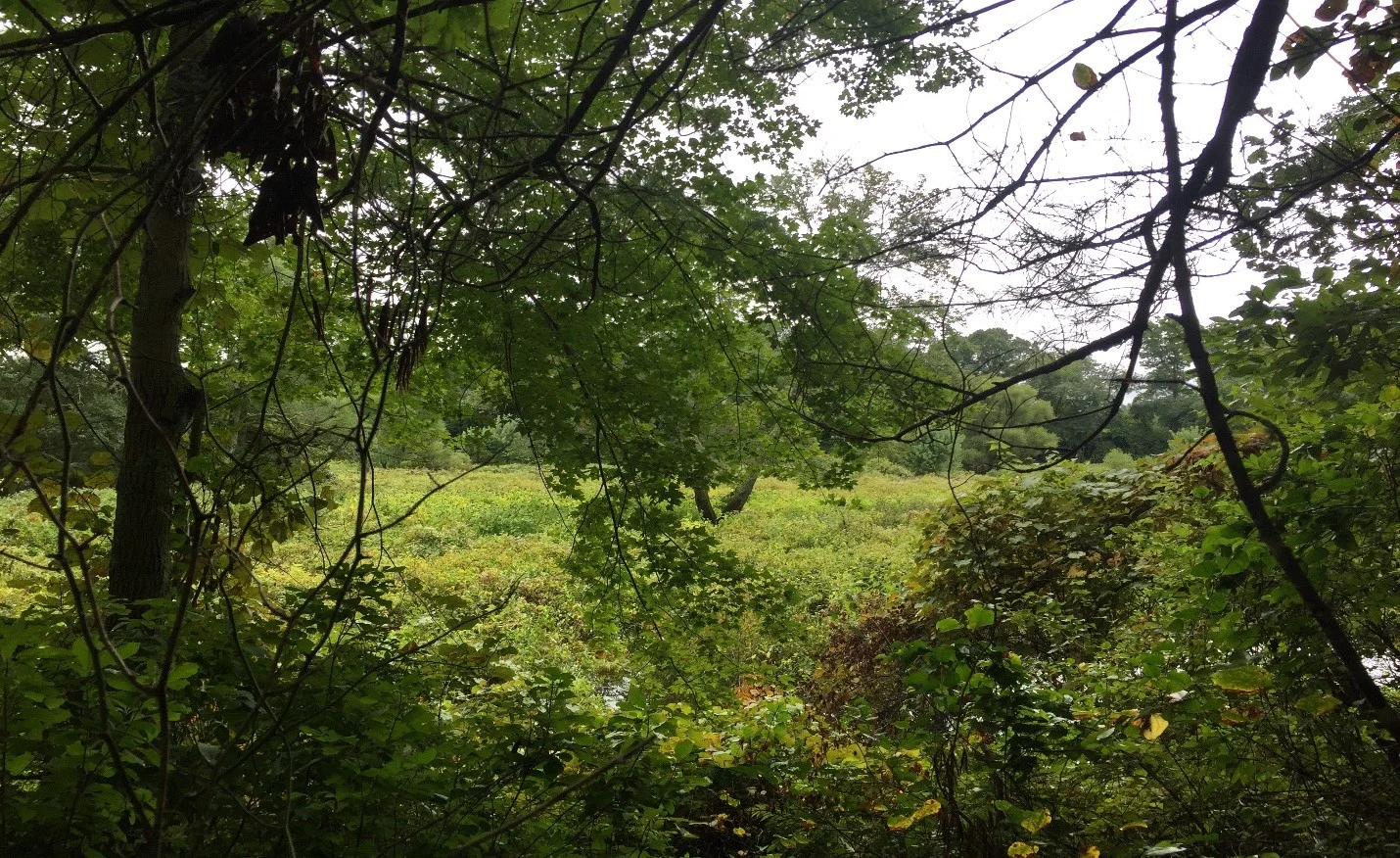
Swamps, marshes, bogs, and fens; all ecosystems defined by various sub-types and characteristics with one thing in common: they are all wetlands. World Wetlands Day was February 2, marking the date the Convention on Wetlands was adopted in 1971 and raising awareness of wetlands and their vital role to our planet. Massachusetts was the first state in the nation to adopt wetland protection laws during the 1960s; however, since the Colonial Period, roughly one-third of the state’s wetlands have been destroyed[1]. According to the EPA, “wetlands in coastal watersheds are experiencing disproportionate losses compared to wetlands in the rest of the country, making them particularly important areas for protection”[2]. Wildlands’ work to protect undeveloped land throughout the region includes the protection of wetlands. In fact, nearly all of the properties in Wildlands’ portfolio contain some type of wetland and provide habitat for many different species throughout the region; some of which are rare or endangered, such as the eastern box turtle and northern red-bellied cooter.
Drone view of Raven Brook in Middleborough.
Recently, I spoke with Brad Holmes, manager of Environmental Consulting & Restoration, LLC (ECR) to learn about what wetlands are and how they impact Southeastern Massachusetts. Located in Plymouth, ECR specializes in wetland consulting, permitting and restoration, and Brad, a professional wetland scientist (PWS), has worked with Wildlands at Great River Preserve and most recently, on the ecological restoration project along the shore of Halfway Pond. Read on to learn about wetlands and their significance to our region:
What is a wetland?
A wetland is an area where groundwater is located at or near the surface and where the vegetative community is dominated by plants adapted to live in saturated soil conditions. Wetlands often border on creeks, rivers, streams, ponds, lakes etc., but may also be isolated. Wetlands are [determined] by assessing three specific site conditions that include vegetation, soil, and hydrology. By definition, a wetland must include 2 of 3 conditions: a dominance of wetland vegetation, hydric soils, and/or hydrological conditions.
What is a wetland scientist?
A Professional Wetland Scientist is an individual that has been certified by the Society of Wetland Scientists based on academic and work experience in wetland science. As a PWS we work to assess and manage wetland resource areas throughout Massachusetts. Our work includes field delineation of wetlands based on specific environmental conditions (i.e. vegetation, soils & hydrology) as well as designing and permitting projects through the applicable local, state and federal regulatory authorities.
In addition to your work as a PWS, you are certified by the MA Arborists Association as an arborist, how does this influence your approach to your work?
As an MA Certified Arborist, I approach projects with a special consideration towards the care of trees, specifically when designing wetland restoration or wetland replication projects.
North River in Marshfield.
What are the benefits of wetlands?
Wetlands provide benefits to landowners and the public, [including] protection of public and private water supply, protection of groundwater supply, flood control, storm damage prevention, prevention of pollution, protection of fisheries and protection of wildlife habitat.
Why is important to protect them?
Wetlands act as a first line of defense for floodwater from storms. They also act as a filter to pollutants in our water supply. They [also] provide a specific habitat that many wildlife and fish need to survive.
Do wetlands have any significance to Southeastern Massachusetts?
There are many extensive wetland systems within Southeastern Massachusetts. For instance, the North River system in Scituate, Marshfield, Norwell, and Pembroke. Also consider the Taunton River system, the extensive freshwater ponds and the 250+ miles of coastline in Massachusetts.
It is important for property owners and the general public to be aware of the wetlands in their community and where they can seek guidance in protecting the wetland resource areas.
What is the current state of wetlands in this region? Are they threatened? If so, what can people do to help?
Wetlands in Massachusetts are protected by the Massachusetts Wetlands Protection Act and associated Wetland Regulations. [These] spell out specific performance standards for work within or nearby (buffer zone) wetland resource areas. It is important for property owners and the general public to be aware of the wetlands in their community and where they can seek guidance in protecting the wetland resource areas. Many towns in Massachusetts have a local Conservation Commission that works to protect the resource areas in their community.
What do you think the future of wetlands is?
Wetlands will be protected. The next task is protecting more land buffering wetlands, which is the current struggle.
Wetlands at Striar Conservancy, Halifax
Want to learn more about wetlands and whether there are any near your home? Talk to your local Conservation Commission, go to the State’s website on wetlands, or, if there is a Wildlands property near you, ask us what type of wetland is on the property and how you can help in maintaining its integrity for the benefit of your town and the animals that rely on its habitat. I’d like to thank Brad for taking the time to answer my questions and providing some great insight on the importance of wetlands and their impact on our region.
Land Projects Heat Up as the Weather Cools Down
By Scott MacFaden, Director of Land Protection
Often a productive time of year for land preservation projects, this November proved particularly so for Wildlands. We completed a purchase in Plymouth and a land donation in Halifax that expanded two of our largest preserves, Halfway Pond Conservation Area and Striar Conservancy.
In Scituate and Plymouth, partnership projects reached a critical juncture and a closing, respectively. In Scituate, town meeting voters approved the purchase of MacDonald Farm, a beloved local landmark on 1st Cliff, and the town of Plymouth purchased an 88-acre property that includes one of the town’s highest-elevation landforms, the striking Hio Hill.

Early morning mist at Halfway Pond.
Halfway Pond Conservation Area Addition | Plymouth
A few days before Thanksgiving, Wildlands completed the purchase of an 11.4-acre parcel on Halfway Pond in Plymouth from the Waltham-based Advaita Meditation Center. This acquisition complements recent acquisitions we have made over the past several years near Halfway Pond and further expands Halfway Pond Conservation Area, one of our oldest, largest, and most beloved preserves.
A rectangular-shaped parcel with varying topography, this property is primarily wooded upland and includes over 470 feet of frontage on Halfway Pond. It is integral to our ongoing effort to pursue ecological restoration efforts along the pond’s shore that will allow for the revegetation of native species. Wildlands now owns almost all of Halfway Pond’s western shoreline.
A generous private donor supplied all of the funding for this acquisition. Wildlands is fortunate to enjoy the support of such donors who share our belief in the importance, indeed the imperative, of preserving our region’s natural heritage.

A snowy owl at rest at MacDonald Farm.
Photo courtesy of Jim Petit.
MacDonald Farm | Scituate
On November 14, voters at Scituate’s special town meeting voted to approve the town’s purchase of MacDonald Farm, the last remaining undeveloped parcel on 1st Cliff and one of the few remaining along the town’s 21-mile coastline.
MacDonald Farm includes 600 feet of frontage on Scituate Harbor, abuts other open space parcels and NOAA’s Stellwagen Bank National Marine Sanctuary headquarters, and is a significant component of the vista from multiple vantage points in Scituate Harbor. In decades past, saltmarsh hay and Irish moss were harvested from its shores.
The town will use Community Preservation Act (CPA) funds to acquire the property and, in keeping with CPA requirements, will grant a Conservation Restriction on the property to Wildlands following the closing.
MacDonald Farm has been a long-time preservation priority for local stakeholders, including 1st Cliff resident and abutter Mary Jenkins, and NOAA. Mary co-sponsored the application we submitted to the Scituate Community Preservation Committee last summer and was integral to the process of advancing the application through the review and approval process that culminated in the town meeting vote. NOAA representatives, Ben Haskell and Anne-Marie Runfola, provided invaluable support throughout that review and approval process. Wildlands is pleased to have had the opportunity to join the project in its latter stages and collaborate with these local stakeholders, town officials, and volunteers toward advancing the preservation effort.
Hio Hill Preserve | Plymouth
On November 29, the town of Plymouth acquired 88 acres off the east side of Old Sandwich Road in southeast Plymouth. The town used $1.1 Million in CPA open space funds and a $50,000 contribution from Wildlands to purchase the property, also known as Hio Hill Preserve. We were able to provide this critical complementary funding courtesy of a generous private donor.
Hio Hill Preserve is entirely wooded upland, with notably diverse topography. Its most prominent feature is its namesake hill, one of the highest elevation landforms in all of Plymouth. Hio Hill’s broad summit plateau offers views of Cape Cod Bay as well as much of the surrounding landscape. It directly abuts other open space parcels, including town-held land, and sits just across Old Sandwich Road from a 450-acre open space assemblage comprising multiple town open space parcels and our Richard F. Wynn Preserve. It is partially within a Zone II wellhead protection area and helps protect a town drinking water well situated three-fifths of a mile to the southeast.
Wildlands will hold a CPA Conservation Restriction on this outstanding new addition to the town’s portfolio of municipally-owned conservation land.
Along the Winnetuxet River in Halifax.
Striar Conservancy Addition | Halifax
Courtesy of the Stevens family, the last of our November projects included the donation of a 3.6-acre parcel along the lower Winnetuxet River in Halifax. Comprising primarily riparian wetlands, the parcel directly abuts and expands Striar Conservancy, our largest preserve in Halifax, and sits across the Winnetuxet’s expansive floodplain from the town of Halifax’s Randall-Hilliard Preserve, upon which Wildlands holds a Conservation Restriction.
Clyde and Gladys Stevens acquired the property in 1963. With the 2015 passing of Gladys Stevens, the property descended to her heirs, Ernest Stevens and Jeanne (Stevens) Wilson Baum, who graciously donated the parcel to Wildlands. We thank Mr. Stevens and Ms. Baum for their donation of this important component of the Winnetuxet River corridor.
Newly-Formed Coalition Secures Funding for Pembroke Project
Local towns and organizations band together to improve the Indian Head River trail system.
By Community Stewardship Program Coordinator, Conor Michaud

The Indian Head River from atop the hills in Tucker Preserve.
In 1993, Sidney and Harold Tucker gifted the 78.6-acre Tucker Preserve to Wildlands Trust. Since its donation, Tucker Preserve has become a major attraction for hikers and nature lovers throughout the South Shore. Sandwiched between Hanson, Hanover, and Pembroke conservation lands, this preserve has over 2,500 feet of shoreline along the Indian Head River and 1.75 miles of trails. While its natural features are a major attraction, they are not the only source of lure to this protected land. The Indian Head River was once home to the Indigenous tribes of Southeastern Massachusetts, and throughout the 17th and 19th centuries, became an important site of regional industry hosting mills and factories which produced iron work and rubber, among other products.
Together, Tucker Preserve and the conservation lands of Pembroke, Hanson, and Hanover surrounding Indian Head River, make up 325 acres of protected land with over 6 miles of walking trails and easily accessible boating access for canoes and kayaks. Though access to outdoor recreation is plentiful along the Indian Head River trail, the funding to provide adequate trail maintenance, amenity improvements, and educational signage has been lacking over the last several years. As a result of this funding deficiency and the continued devotion to providing public access to these historic lands, these three towns, as well as Wildlands and the North and South Rivers Watershed Association, came together as the informal Indian Head River Coalition. In February 2018, the Town of Pembroke, on behalf of the coalition, submitted a funding request to the federally funded Recreational Trails Program (RTP) to grant funding which would allow the necessary improvements to the Indian Head River Trail System.

A kayaker enjoys a quiet trip down the tranquil waters of Indian Head River.
This past September, the officially titled “Indian Head River Greenway Trail System Project” was selected for funding with work slated to begin in November 2018 and wrap-up in December 2021. The recently awarded RTP grant is provided by the Department of Transportation’s Federal Highway Administration and awarded and regulated to Massachusetts grantees by the Department of Conservation and Recreation. The Indian Head River Coalition was awarded $41,487 towards the trail project and will be required to match 20 percent of this funding throughout the three-year venture. Wildlands Community Stewardship Program will manage the project by facilitating trail work with volunteers and staff to complete all existing trail maintenance, new trail construction, and amenity improvements. Wildlands will also be working with a graphic designer and the North and South Rivers Watershed Association to create updated trail maps and educational signage throughout the trail system specifically highlighting the history and ecology of the Indian Head River.
The Indian Head River Coalition designed the project to benefit the greater South Shore community by preserving this historic, natural area and providing improved access for all non-motorized passive users. In addition, the project and the RTP grant program exemplifies the partnerships that can form between municipalities, nonprofit organizations, and State and Federal Government to achieve conservation efforts specifically designed for public enjoyment and the improvement of public and environmental health.
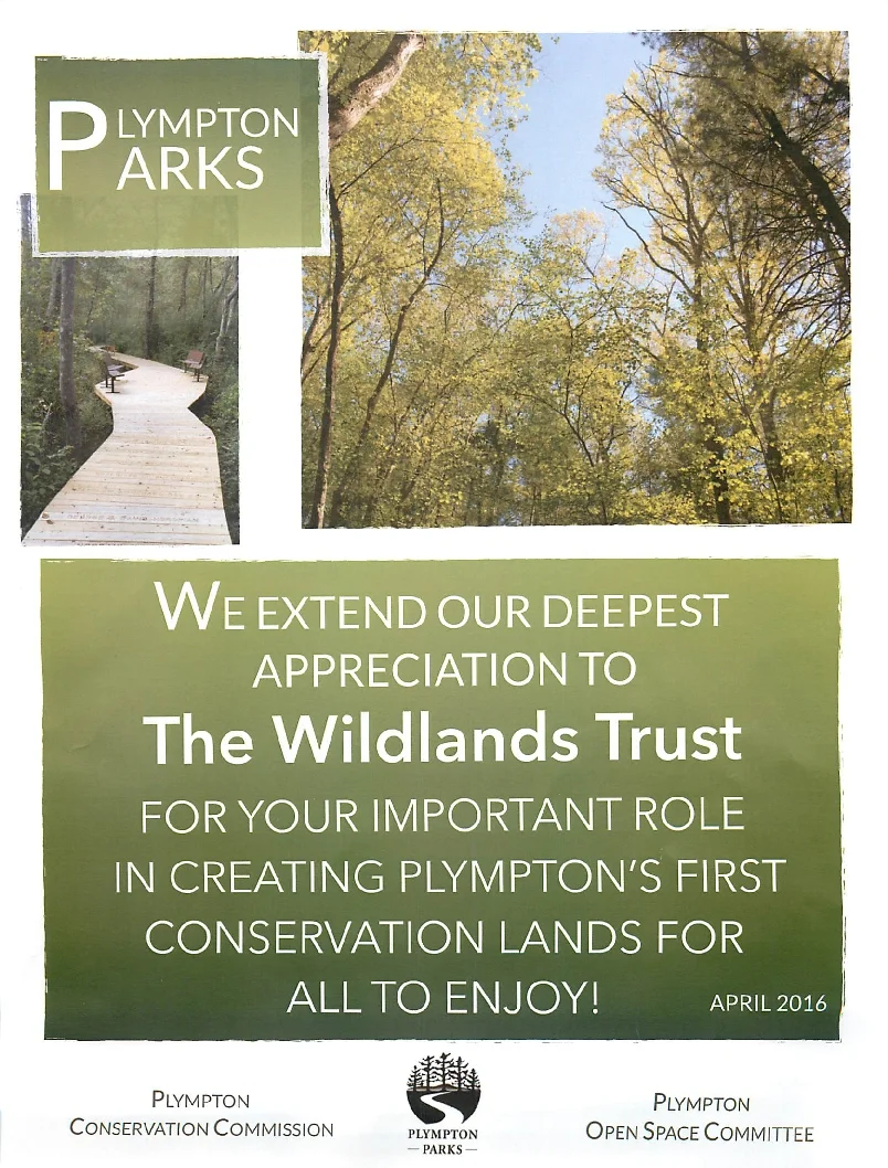
One of the Region’s Most Rural Communities Protects its First Pieces of Public Open Space
Wildlands Trust was honored to be part of the ceremony held recently to celebrate the opening of Plympton’s first conservation lands, Cato’s Ridge and Churchill Park. Karen Grey, Executive Director of Wildlands Trust, was a featured speaker at the event held to honor the many partners who helped bring this project to fruition. Grey’s comments addressed the importance of the Community Preservation Act in local land protection. In this case, a $22,000 contribution from Plympton CPA funds leveraged the permanent protection of over 100 acres of open space.
Rain and mud did not deter the crowd of almost 100 people from coming out to celebrate this momentous occasion. We congratulate all involved with impressive accomplishment.