

What’s New at Wildlands
Year in Review: What We Protected in 2025
Plus: What You Read in 2025 — Top Stories from Wildlands E-News
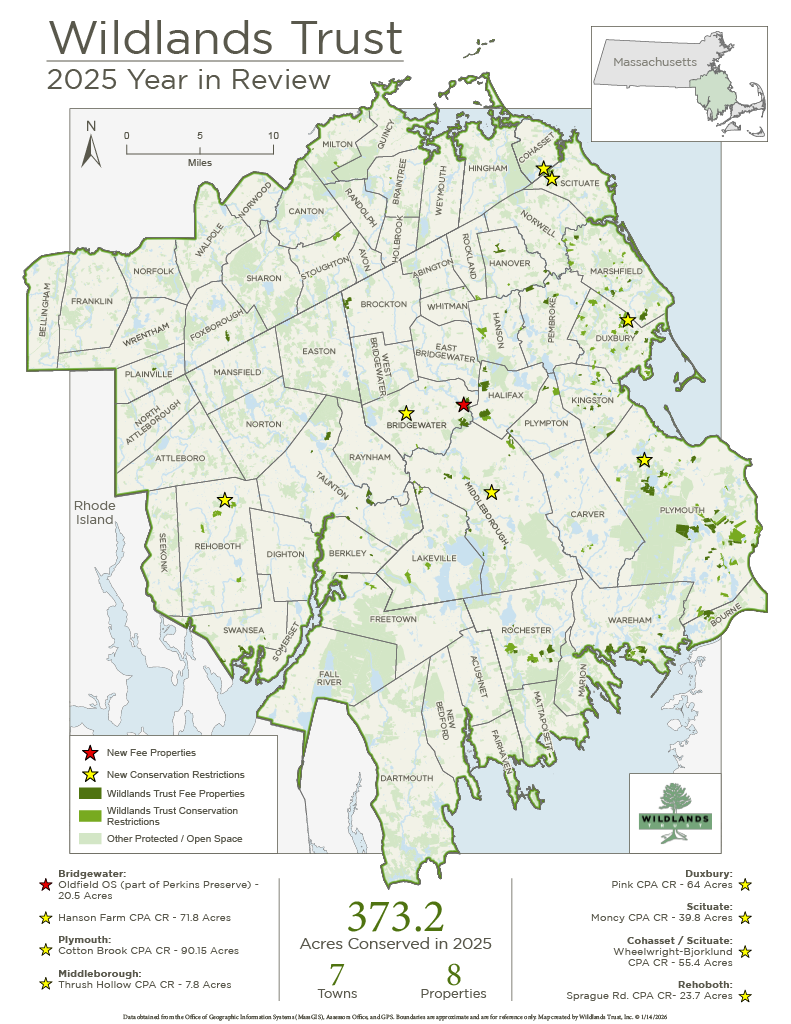
Wildlands’ 2025 land protection projects. Click the map to view a full PDF.
New Year’s Reflections from the Land Protection Office
By Scott MacFaden, Director of Land Protection
Helping CPA Towns Turn Investment into Impact
We completed five new Community Preservation Act (CPA) Conservation Restrictions (CRs) in 2025: the Hanson Farm CR in Bridgewater, the Cotton Brook Preserve CR in Plymouth, the Thrush Hollow CR in Middleborough, the Pink CR in Duxbury, and the Sprague Road CR in Rehoboth. Although these CRs are in different communities and protect different types of habitats, the connecting thread between them is that they all represent locally driven land conservation projects enabled in large part by CPA funds. A quarter-century after it became law, the CPA remains an invaluable asset to community-driven land preservation.

Hanson Farm in Bridgewater.
Saving Farmland
The Hanson Farm CPA CR in Bridgewater was the highlight of the year for farmland protection projects. We now co-hold a CR with the Town of Bridgewater on the 72-acre Hanson Farm, the last working farm of scale in Bridgewater and regionally beloved for its ice cream stand and farm store. The CR will forever ensure the protection of this last bastion of Bridgewater’s agricultural heritage.
Conserving Land in New Towns
We continued to expand our geographic footprint by adding two new communities to our portfolio through the acceptance of two CPA CRs previously held by the Maxwell Conservation Trust in Scituate and Cohasset. Collectively protecting 96 acres in the West End neighborhood, primarily in Scituate but including a small portion in Cohasset, these CRs encompass a variety of landscapes and habitat features, including scenic woodlands and vernal pools.
Founded in 1997, the all-volunteer and locally based Maxwell Conservation Trust prioritized protecting land in the West End neighborhood and worked closely with the Town of Scituate to successfully complete multiple projects in that area, including the two properties protected by these CRs. Similar to several all-volunteer land trusts Wildlands has worked with, the Maxwell Conservation Trust eventually determined it could no longer continue as an active organization and sought a qualified successor to accept an assignment of its CRs before shutting down its operations. Learn more here.
Looking Ahead to 2026
We’re excited about several new farmland projects that are either underway or in the early stages of preparation. In the former category, we’re working with the Friends of Holly Hill Farm and the Town of Cohasset toward completing a CR on a currently unprotected portion of that farm. If all goes as anticipated, the CR will be completed by early summer. In the latter category, a project that would achieve a permanent preservation outcome for Hornstra Farms in Whitman is in the planning stages.
Best of E-News: What Inspired You in 2025
When people are informed, connected, and inspired to protect the nature around them, the entire region benefits. That is what Wildlands E-News is all about. Below are five of the most-read E-News articles from 2025.
Curious about a particular aspect of our work or our region’s natural resources? Tell us in the comments below, and we might explore your question in a future newsletter!
Taunton River at Wyman North Fork Conservation Area in Bridgewater.
1. Human History of Wildlands: The Taunton River Watershed
Key Volunteer Skip Stuck continued his popular series in 2025, spotlighting the human history hidden beneath the foliage of Wildlands’ most beloved preserves. In this most-viewed article of 2025, Skip broadens his focus to an entire region—the Taunton River watershed, where Wildlands has prioritized land protection for decades due to its unique ecological and cultural heritage.
2. Land Protection Update: Duxbury, Scituate, Cohasset
Scott MacFaden recounted Wildlands’ recent land protection victories, including a Conservation Restriction (CR) next to O’Neil Farm in Duxbury and two CRs in Scituate and Cohasset, Wildlands’ first-ever acquisitions in those towns.
Wildlands members receive exclusive updates from our land protection office through their complimentary subscription to our biannual print newsletter, Wildlands News. Become a member today at wildlandstrust.org/membership.
3. White Pine: A Common Tree’s Uncommon History
In his Wildlands E-News debut, local farmer, naturalist, and volunteer hike leader Justin Cifello shines a light on a somehow overlooked giant of our forests—the white pine. From their symbolism in Indigenous and colonial cultures to the surprising reason behind their occasional deformity, Justin traces a history that places the white pine at the center of our region’s social and ecological identity.
4. Welcoming New Staff
We said hello to four new staff members in 2025. Rebecca Cushing joined us in January as one of two new Land Stewards. Callahan Coughlin joined us in February as the second. Already, Rebecca and Callahan have earned new titles to reflect their increasing responsibility: Rebecca is now our Stewardship & Volunteer Coordinator, while Callahan is our Stewardship & Training Coordinator.
In May, we welcomed Rob Kluin as our new Donor Relations Manager. Rob succeeds Sue Chamberlain, who retired after 12 years at Wildlands. In August, Jason Risberg came aboard as our first-ever GIS Manager, giving a major boost to our mapping and analysis capabilities.
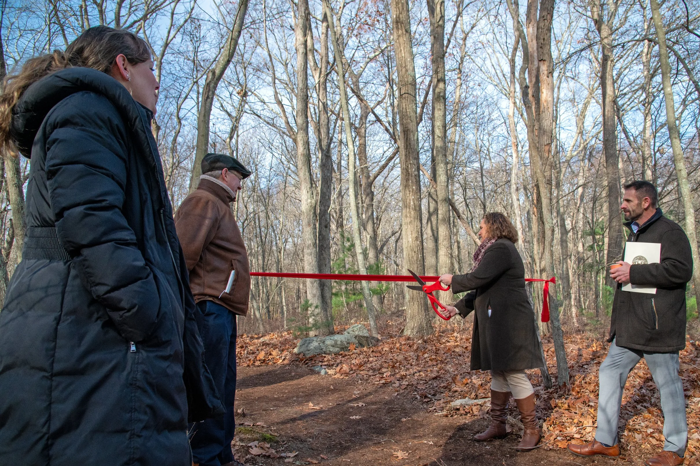
Town of Avon Select Board Member Shannon Coffey cuts the ceremonial ribbon to open Fieldstone Preserve.
5. Fieldstone Preserve Gives Avon & Brockton Residents New Place to Enjoy Nature
In November, Fieldstone Preserve opened to the public, providing Avon, Brockton, and surrounding communities with new access to nature in the region’s densest urban landscape. The 30-acre woodland features 0.7 miles of trails that connect to D.W. Field Park. The Town of Avon acquired the property in 2024 with funds from a state grant and a private foundation, secured by Wildlands Trust. The grand opening ceremony brought together public officials and nonprofit leaders working collaboratively to improve the area via the D.W. Field Park Initiative.

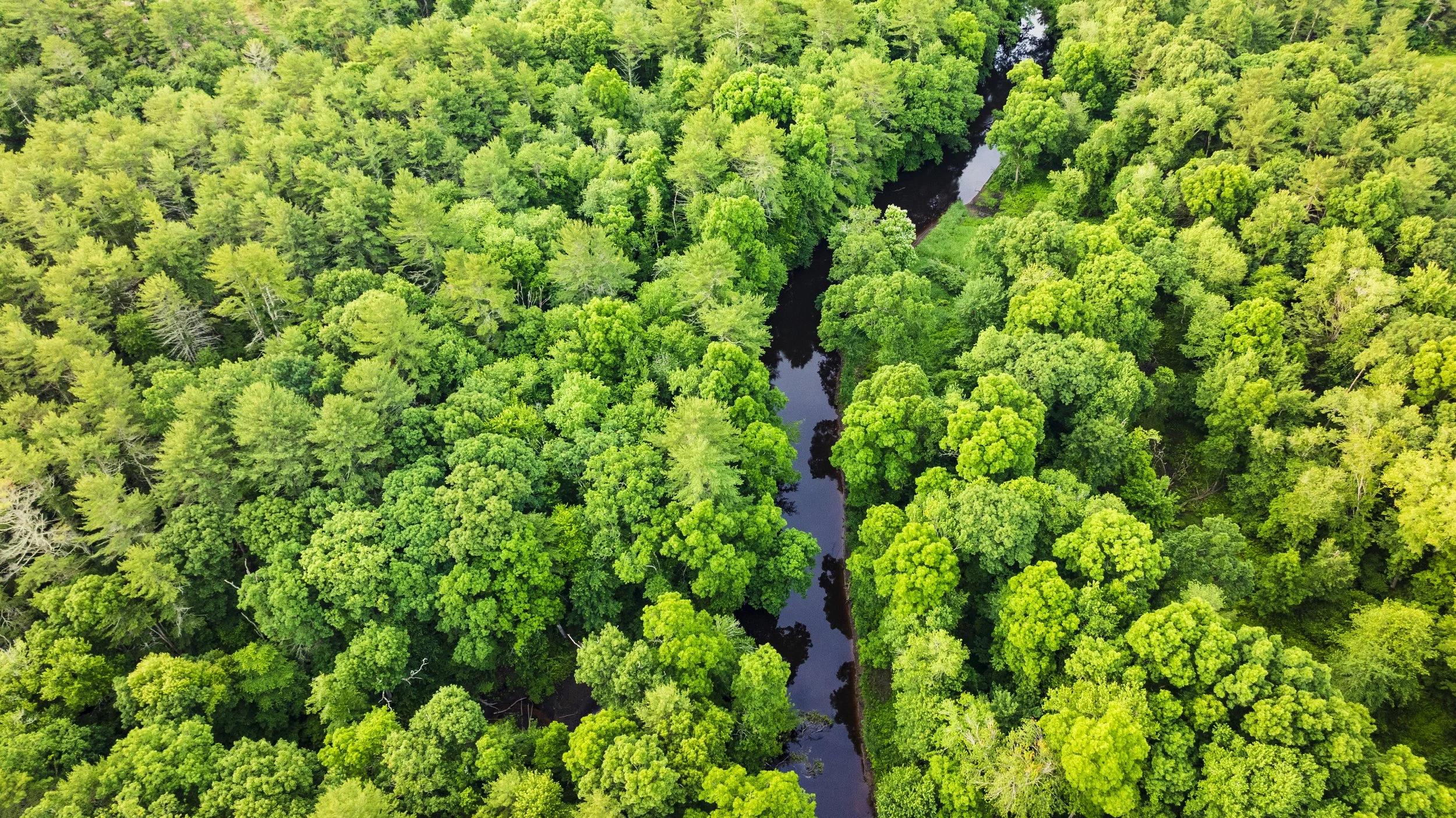
90 Acres Protected on the Taunton River in Bridgewater
The upper Taunton River at Wyman North Fork Conservation Area in Bridgewater. Across the river is Perkins Bridgewater Preserve. Photo by Jerry Monkman.
By Scott MacFaden, Director of Land Protection
Note: The following land protection update first appeared in the Fall 2024 issue of Wildlands News, our biannual print newsletter. Receive early and exclusive Wildlands updates by becoming a member today at wildlandstrust.org/membership.
We are pleased to welcome the newest addition to our portfolio of protected lands along the Taunton River: 90 acres contained in two contiguous parcels along the upper Taunton River corridor in Bridgewater. The property has been named Perkins Bridgewater Preserve.
Located off Cherry Street, the newly acquired land includes 11 potential vernal pools and approximately one mile of frontage on the Taunton River. It is directly across the river from Wyman North Fork Conservation Area, 95 acres owned by Wildlands Trust and the Town of Bridgewater. Collectively, these properties comprise 186 acres—the largest expanse of protected lands along the upper Taunton River corridor above Cherry Street.
Perkins Bridgewater Preserve includes a network of woods roads that we will adapt into hiking trails.
Since 1995, Wildlands has afforded a high priority to protecting land along the Taunton River’s 44-mile mainstem and major tributaries. The river’s designation by Congress in 2009 as a National Wild and Scenic River was further affirmation of its ecological, recreational, and historical significance, and a validation of the efforts Wildlands and its conservation partners have extended toward protecting land along its banks.
With this latest acquisition, Wildlands has helped protect over 2,000 acres on the Taunton River and its tributaries.

Walt Munroe Conservation Area in Rehoboth.
Three Rehoboth CRs Completed
On the cusp of the autumnal equinox, we completed three Community Preservation Act (CPA) Conservation Restrictions (CRs) in Rehoboth. Since it adopted the CPA in April 2009, Rehoboth has been diligently working to use associated funds to acquire properties of high ecological importance.
The new CRs protect three such properties, totaling 130 acres.
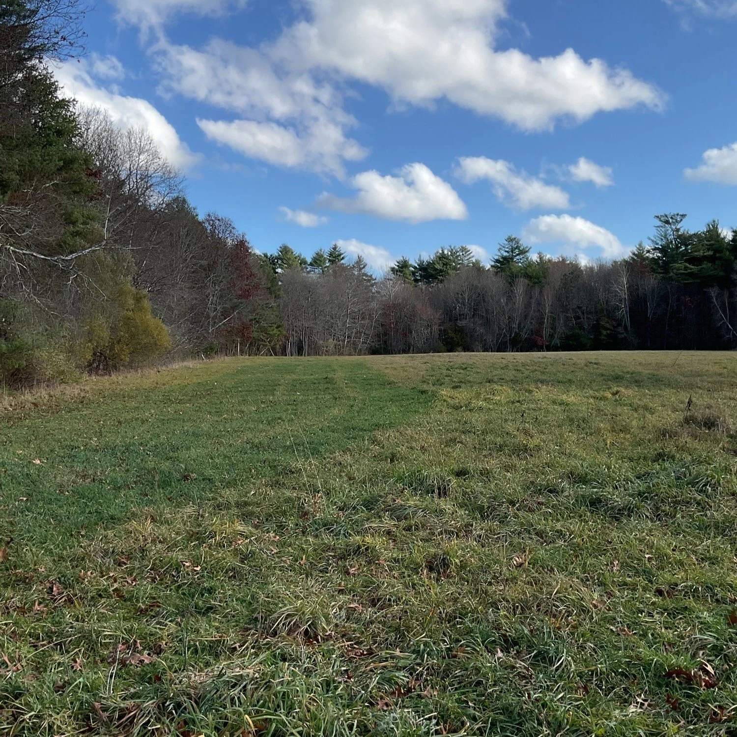
The Walt Munroe Conservation Area CR protects 46 acres acquired by the Town in 2016. The area is notable for its two fields that the Town is working to restore; its extensive frontage along Rocky Run Brook, a Palmer River tributary; and its location within the Munwhagne Swamp complex, a several-hundred-acre area of contiguous open space in southeast Rehoboth that includes several rare natural communities. The property is named in honor of the late Walt Munroe, a seventh-generation Rehoboth resident who, in addition to protecting his own family farm with Wildlands, contributed significant time and effort to helping the Town protect open space.
The Grear Farm CR protects 32 acres acquired by the Town in 2022. The Grear Farm features extensive open fields with prime farmland soils, connects to an assemblage of open space in West Rehoboth along Route 44, and helps protect the water quality of the nearby East Branch of the Palmer River.
The Danforth Street CR protects 50 acres acquired by the Town in 2019. The Danforth Street property includes two potential vernal pools, a hiking trail through topographically diverse terrain, and connectivity with adjacent open space.
Two more Rehoboth CPA CRs are in the pipeline that will collectively protect an additional 54 acres. We look forward to advancing these projects and extend our appreciation to all those Town staff and volunteers who have worked to successfully implement the CPA’s open space dimension in Rehoboth.

Bernie Cooper Riverfront Park Dedicated in Norwood

Ribbon-cutting ceremony for Bernie Cooper Riverfront Park in Norwood.
By Thomas Patti, Communications Coordinator
No one knows a town better than its residents who dedicate their lives to public service. That’s why Wildlands Trust begins every conservation project by listening to local leaders and helping them achieve their community’s unique open space goals.
In Norwood, a fledgling 6.8-acre park proves what’s possible when passionate townspeople take initiative over the future of their natural spaces, and conservation professionals provide the expertise needed to turn residents' vision into a reality.
On May 9, a ribbon-cutting ceremony celebrated the dedication of Bernie Cooper Riverfront Park. Nestled between Balch Elementary School and the Neponset River in the environmental justice neighborhood of South Norwood, Bernie Cooper Riverside Park will pack outsized social and environmental impact into its modest acreage. With wheelchair-accessible trails, an outdoor classroom, river overlooks, and green stormwater infrastructure, the park will give all Norwood residents a chance to connect with nature.

After the ceremony, project partners explored the park, despite torrential rain.
In 2018, the parcel was set to be converted to a parking area for a car dealership’s overflow inventory. With a shared vision for the land and its local people and wildlife, the community came together to chart a better way forward. Two years later, the Town of Norwood acquired the property using Community Preservation Act (CPA) funds. In accordance with CPA requirements, the Town granted a Conservation Restriction (CR) on the property to Wildlands Trust, permanently protecting it from development. The CR marks Wildlands’ first acquisition in Norwood.
A community design process ensued, led by the Town of Norwood, the Horsley Witten Group, Offshoots, Inc., and the Neponset River Watershed Association. Construction began in 2024. Awards from two state programs, the MassTrails Grant Program and the Land and Water Conservation Fund Grant Program, helped fund the design and construction.

The ribbon-cutting ceremony also honored the legacy of Bernie Cooper, who served the Town of Norwood for 49 years as assistant town manager and civil defense director. Cooper died in 2021.
“This park, like Bernie, represents growth, community, and the enduring power of nature,” said Patty Bailey, chair of the South Norwood Committee. "It's a living tribute to someone who dedicated their life to making our community a better place.”
“[My dad’s] tireless energy, the love for his town, and the deep sense of responsibility is reflected in the park,” added Amelia Noel, Cooper’s youngest daughter. “This space isn’t just a collection of trails and trees; it’s designed for everybody. ... It’s a place where neighbors will gather, where families will play, and where people will build the kind of community he believed so deeply in.”
Wildlands Trust is proud to play a small role in forever rooting Cooper’s legacy to the natural landscape of Norwood. We are grateful for the dedicated public servants in every town we serve, who make our work possible.


Land Protection Update: Duxbury, Scituate, Cohasset

Bates Lane Conservation Area in Scituate.
By Scott MacFaden, Director of Land Protection
Editor’s Note: This land protection update first appeared in the Spring 2025 issue of Wildlands News, our biannual print newsletter for Wildlands Trust members. Be the first to hear about Wildlands projects and events by becoming a member today at wildlandstrust.org/membership.
Another Duxbury CPA CR in Hand
In November 2024, we completed the DeLorenzo Community Preservation Act (CPA) Conservation Restriction (CR) in Duxbury.
The 27-acre DeLorenzo property was a priority for preservation primarily because of its direct proximity to the northern portion of the Historic O’Neil Farm, potential to support agricultural activities, wildlife habitat value in the form of two potential vernal pools, and location within a Zone II Wellhead Protection Area.
Duxbury residents approved the purchase of the property at the Annual Town Meeting in March 2018, and the Town closed on the land in October 2018. The Town used CPA funds to acquire the Property. The Town is granting the CR to Wildlands to comply with the CPA’s requirement that every CPA-funded open space acquisition be protected with a CR running to a qualified third-party entity.
The DeLorenzo property in Duxbury, along its boundary with the O’Neil Farm.
The DeLorenzo parcel is irregularly shaped and includes two non-contiguous areas of road frontage on Route 53. Apart from a cleared area in its center and a rectangular strip of open field running parallel to its southern boundary line with the O’Neil Farm, the property is primarily wooded. It includes two distinct areas of mixed deciduous/coniferous wooded wetland, with the largest such area extending southwesterly into the O’Neil Farm. Topography is mostly level.
A local farmer licenses a portion of the DeLorenzo property from the Town to raise sheep, goats, and chickens, and maintain beehives. The farmer’s future plans include constructing hoop houses to grow produce and establishing a seasonal farmstand.
Wildlands Accepts Assignment of Two CRs in Scituate and Cohasset
On May 1, in the latest of a series of partnerships with local land trusts in our service area, we accepted an assignment of two CRs comprising 98.4 acres, mostly in Scituate and partially in Cohasset, from the Maxwell Conservation Trust. Formed in 1997, the Scituate-based all-volunteer land trust is legally dissolving and identified Wildlands as a qualified entity to accept the CR assignments.
Over the past two decades, we have collaborated with several all-volunteer land trusts that determined their most prudent option was to transfer their assets and then dissolve, including the Swansea Land Trust, the Milton Land Conservation Trust, and the Brockton Audubon Society.
Bates Lane Conservation Area in Scituate.
Both CRs protect land owned by the Town of Scituate and located within a 330-acre expanse of Town conservation land known as the Bates Lane Conservation Area.
Completed in 2007, the Moncy CR protects 45.3 acres along the north side of Bates Lane and two smaller contiguous parcels situated approximately 1,000 feet to the north. All three parcels are primarily wooded upland but include pockets of wetlands. The Moncy CR is situated within areas the Commonwealth’s Natural Heritage and Endangered Species Program (NHESP) identifies as significant wildlife habitats.
Completed in 2011, the Wheelwright-Bjorklund CR protects 53 total acres—51.1 acres in Scituate and 2 acres just over the municipal boundary in Cohasset. The land protected by this CR is primarily wooded and mostly upland, with variable topography. The Wheelwright-Bjorklund CR is also situated within multiple areas NHESP identifies as significant wildlife habitats.
The CRs represent our first acquisitions of any kind in Scituate and Cohasset.
We thank the Maxwell Conservation Trust for its years of dedication to preserving land, and for entrusting these CRs to our stewardship.
Human History of Wildlands: Halfway Pond Conservation Area
We have all played with jigsaw puzzles at one time or another. Opening the box, we see pieces of color that bear no resemblance to the finished product. The work is in their reassembly. In many ways, land preservation is like a jigsaw puzzle—identifying and assembling small, seemingly unrelated pieces until they reveal a larger, cohesive picture. This is especially true in areas as long occupied as Plymouth, Massachusetts.

By Skip Stuck, Key Volunteer
We have all played with jigsaw puzzles at one time or another. We select one based on a picture on the box that displays what the puzzle should look like when complete. Opening the box, we see pieces of color that bear no resemblance to the finished product. The work is in their reassembly. In many ways, land preservation is like a jigsaw puzzle—identifying and assembling small, seemingly unrelated pieces until they reveal a larger, cohesive picture. This is especially true in areas as long occupied as Plymouth, Massachusetts.
Until about 12,000 years ago, this land was covered by a glacier, up to a mile thick. Over the next 2,000 years, the climate warmed and ice retreated, creating a land surface composed of rocks, gravel, and sand that had been carried in the glacier. This "outwash" plain created the topography we see throughout Southeast Massachusetts, Cape Cod, and the Islands, featuring rocky hills and kettle ponds formed by huge pieces of melting ice. One of these kettle ponds, Halfway Pond, lies amid a concentration of such ponds in Plymouth, known collectively as the Six Ponds. The others include Bloody Pond, Little Long Pond, Long Pond, Gallows Pond, and Round Pond.
Early human history
Native peoples soon followed the retreating ice and utilized these new forests, ponds, and rivers to supply their food and shelter needs. For thousands of years, they and their cultures flourished. Especially important were the spring runs of blueback herring and alewives from the Agawam River, which outflows from Halfway Pond, and the Manomet (or Monument) River, which flowed from Herring Pond. These people, forebears of the Wampanoag Tribe who occupied the area at the time of European settlement (and still today; see Herring Pond Wampanoag Tribe), have been identified in historical documents by many names: the Patuxet, Comassakumkanit, Manomet and Pondville Indians. In fact, Halfway Pond got its name because it was halfway between the Dutch and Indian trading posts at Aptuxet (now Bourne, MA) to the south and the original Plymouth English settlement to the north. A trail known as the Indian Path or the Herring Way was a well-used route from Herring Pond to Halfway Pond.
While the geography suited the Indigenous people’s lifestyle of hunting, gathering, fishing, and subsistence farming, the English were slow to move out of the original colony at Plymouth Harbor. The earliest mentioned settlement at Halfway Pond is that of Nicholas Snow, who in 1637 was appointed to repair and manage a fish weir on the Agawam. Others followed, but not immediately in great numbers.
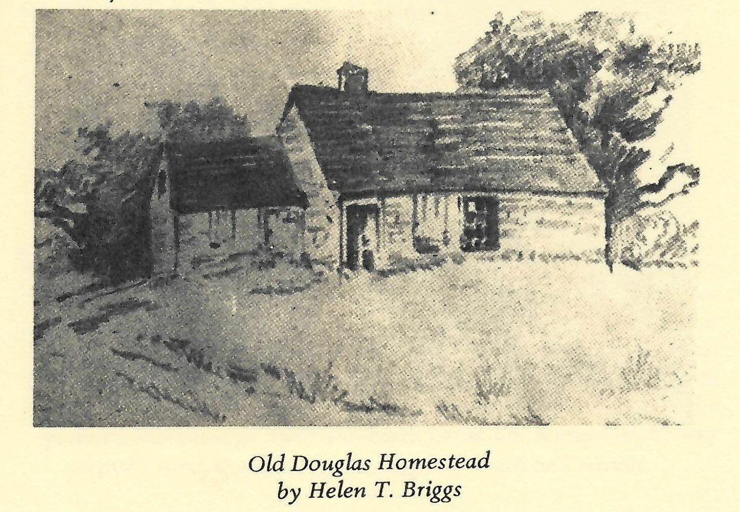
Above: The Old Douglas Homestead. In Plymouth’s Ninth Great Lot and the Six Ponds, 1710-1967, A Chronicle. “John Douglas was born in Middleboro in 1752 and married Lydia Southworth. He became a schoolteacher in 1786 and moved to Plymouth and settled in the neighborhood known as Halfway Pond. He bought the sawmill from Belcher Manter, Morton and Jonathan Wing for $750. … He built a house on the Agawam which became ‘the old homestead’ to many generations of the Douglas family until it was destroyed by the hurricane of 1938” (10). For much of the 20th century, descendants of the Douglas family lived and worked on Davis-Douglas Farm, which they sold to Wildlands Trust for our headquarters in 2012.
Cutting the puzzle pieces
When the Pilgrims arrived in Plymouth, the lands of the new colony were controlled by a group of English investors known as the Adventurers, who funded the initial colony. When their contract ran out, a new patent was granted to Governor William Bradford in 1629, giving the colony freedom to divide and sell their lands. By 1710, about 30,000 acres of land claimed by the colony was still undivided. These lands were cut up into the 10 "Great Lots." Halfway Pond and the five other aforementioned ponds lay at the center of the Ninth Great Lot. In 1713, a meeting was held that created 18 divisions of the Ninth Lot. Those granted land abutting Halfway Pond included John Harlow, Jonathan Snow, John Churchill, Nathaniel Thomas, Jabez Shurtleff, and Deacon Thomas Clark. There is no record—and it is highly doubtful—that any members of the Wampanoag Tribe were consulted in this matter.
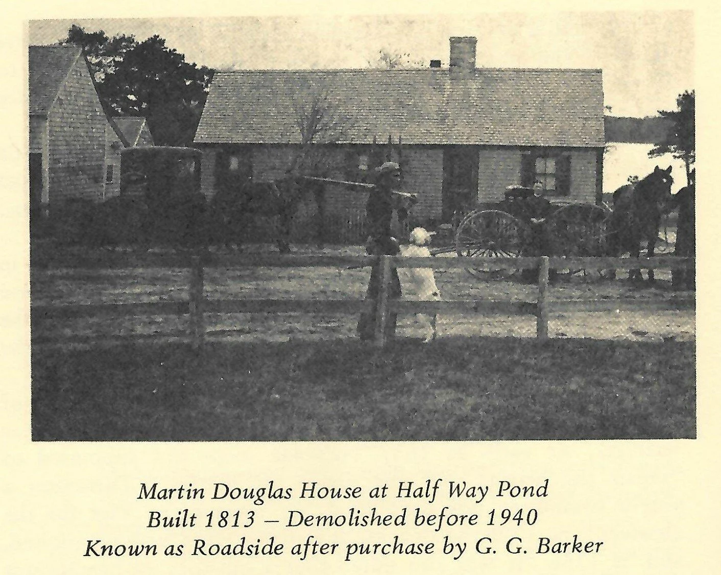
At this point, English settlement of the area accelerated. The Halfway herring run provided an increasingly important resource for food, fertilizer, and trade. Sawmills and stave mills appeared on the Agawam River, including one built in 1781 owned by Belcher Manter and another built in 1847 owned by Thomas Pierce. In 1786, as the settlement known as Halfway Village on the pond's southwest side grew, John Douglas established a grammar school, at one time serving as many as 50 students.
By the mid-19th century, general family farming in the area began to shift toward cranberry growing. The ample water, flat lands around Halfway Pond, and availability of sand were quite agreeable to this new agricultural pursuit. As often happens, the success of the small farmers attracted investors. By the 1890s, LeBaron Russell Briggs and his brother-in-law, George Gardner Barker, had purchased most of the land surrounding Halfway Pond. George Barker soon built the family homestead, Wyanoke, on the pond. His son LeBaron Barker was a very successful grower, reputed to be the largest independent cranberry grower in America by the turn of the century. He built his mansion on a hill adjacent to the pond. For the next 80 years, all of the lands surrounding Halfway Pond remained in private hands, as cranberry bogs or increasingly as forested land.
Assembling the puzzle

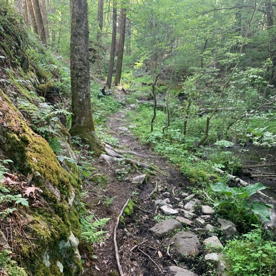
Red pines on Gramp’s Loop in Halfway Pond Conservation Area. Red pine stands were planted extensively across New England between 1930 and 1960 as a timber alternative to white pines, which are susceptible to insect and fungal pests. Now, many red pines are dying due to red pine scale and pine bark beetles.
With the protection of the adjacent Myles Standish State Forest in 1916 (with improvements by the Civilian Conservation Corps in the 1930s), a vision emerged of what Halfway Pond could become if the separate holdings could be protected and united. It would take time and strategic collaborations, but the fledgling Plymouth County Wildlands Trust and its board believed it could be accomplished. In 1982, the family of LeBaron Briggs donated, with assistance from the Nature Conservancy, 242 acres called the West Shore. On the pond's east side, the Briggs family also gifted 56 acres at Gallows Pond in 1982. In 1986, Irene and Saul Taylor gifted an additional 61 acres abutting the West Shore. In 1987, the Conant family gifted 27 acres to string together more of the eastern shore. In 1998, the Nature Conservancy donated land on the east side of Halfway Pond that today encompasses the Big Point section of the property. From 1999 to 2022, a series of land purchases bolstered the protection of Halfway Pond’s western shore, including the former estate of LeBaron Barker, now the site of the Stewardship Training Center.
Wildlands could not have done it alone. MassWildlife proved to be an important partner, purchasing and protecting much of the eastern and southern shoreline. In addition to the Nature Conservancy's support in the acquisition of the West Shore property, it also owns and protects Halfway Island, home of rare old-growth forest. Finally, the AD Makepeace Company, the area's largest cranberry grower, agreed to take three of its bogs adjacent to Halfway Pond out of production, ending the danger of fertilizers and pesticides entering the pond.
All of the puzzle pieces fit into place, and the result has been the protection of 85 percent of Halfway Pond's shoreline, including over 500 acres of adjacent buffer land that now make up Halfway Pond Conservation Area. The Conservation Area, together with Myles Standish State Forest and additional protected lands, now represents the largest contiguous open space assemblage in Eastern Massachusetts. The project took over 40 years. But important things take time.
Learn More
Please visit Wildlands Trust’s online property description of Halfway Pond Conservation Area at wildlandstrust.org/halfway-pond-conservation-area—or better yet, visit its many trails yourself.
In addition, see the following resources that were used to prepare this history.
Plymouth's Ninth Great Lot and the Six Ponds, 1710 -1967, A Chronicle by Ruth Gardner Steinway.
The Herring Pond Wampanoag Tribe website: herringpondtribe.org
The North and South Rivers Watershed Association website: nsrwa.org
I also wish to thank Scott MacFaden, Wildlands’ Director of Land Protection, and Thomas Patti, Wildlands’ Communications Coordinator, for their assistance and feedback.
If you or someone you know has information about Halfway Pond’s history, we would love to hear from you! Share your insight (and/or photos!) with Communications Coordinator Thomas Patti at tpatti@wildlandstrust.org.