

What’s New at Wildlands
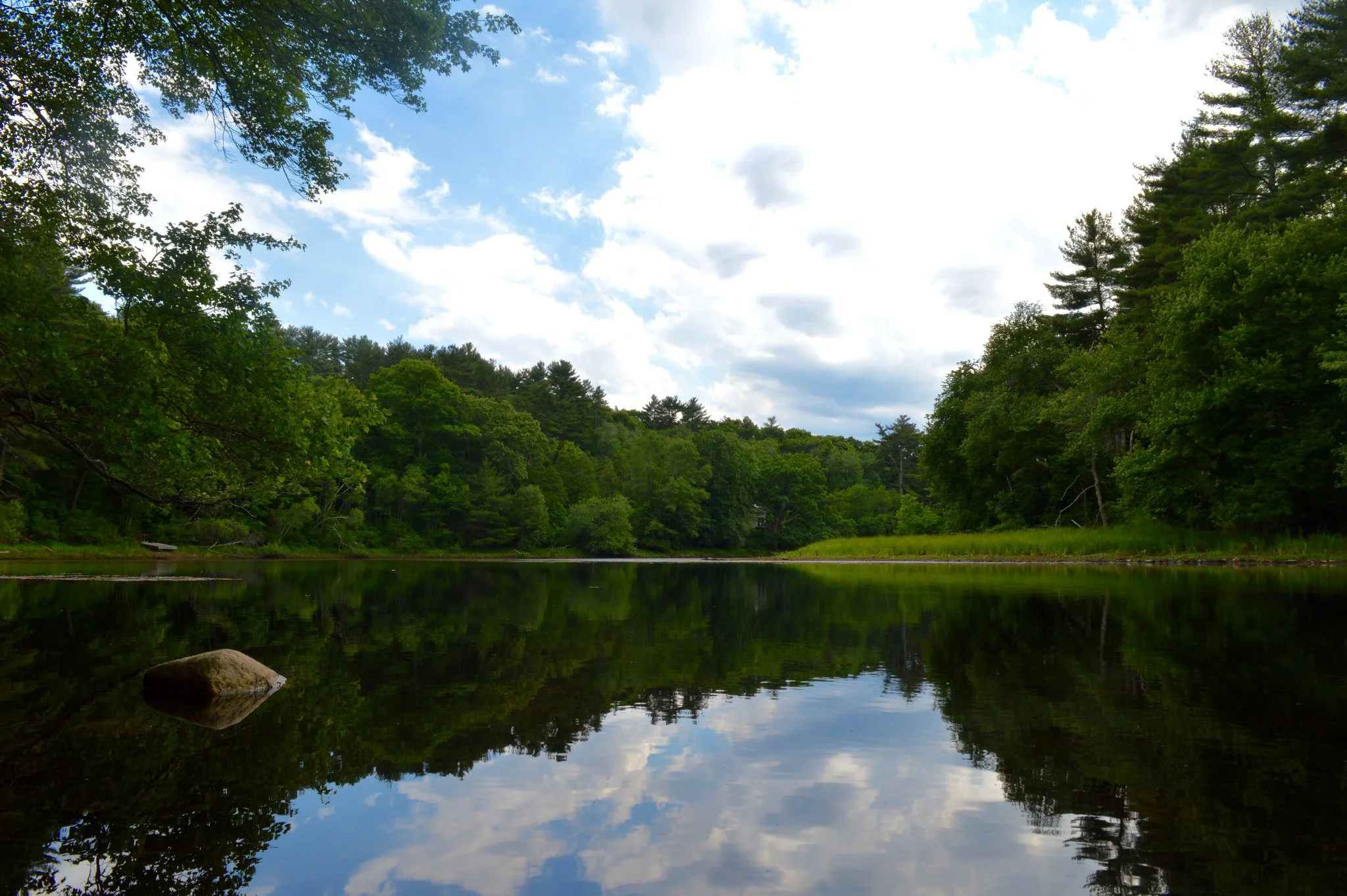
Human History of Wildlands: Great River Preserve
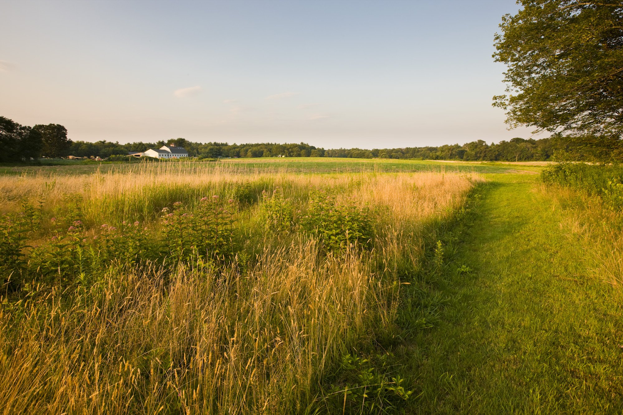
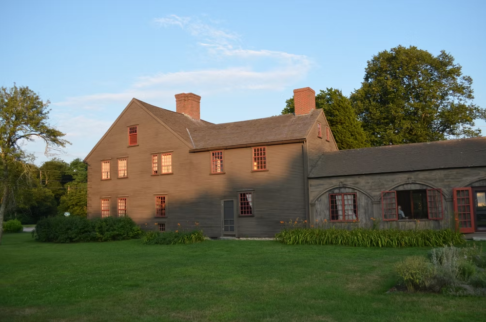
Great River Preserve in Bridgewater. Photo by Jerry Monkman.
By Skip Stuck, Key Volunteer
Throughout this "Human History of Wildlands" series, I've highlighted a wide range of ways that Native Americans, European settlers, and others have utilized and altered the Southeastern Massachusetts landscape, from clearing forests for farms to damming rivers for factories. Few parcels in our region have looked any one way for long. So, when Wildlands Trust undertakes responsibility for a new preserve, it often confronts a difficult question: Which version of the land’s history do we preserve or restore?
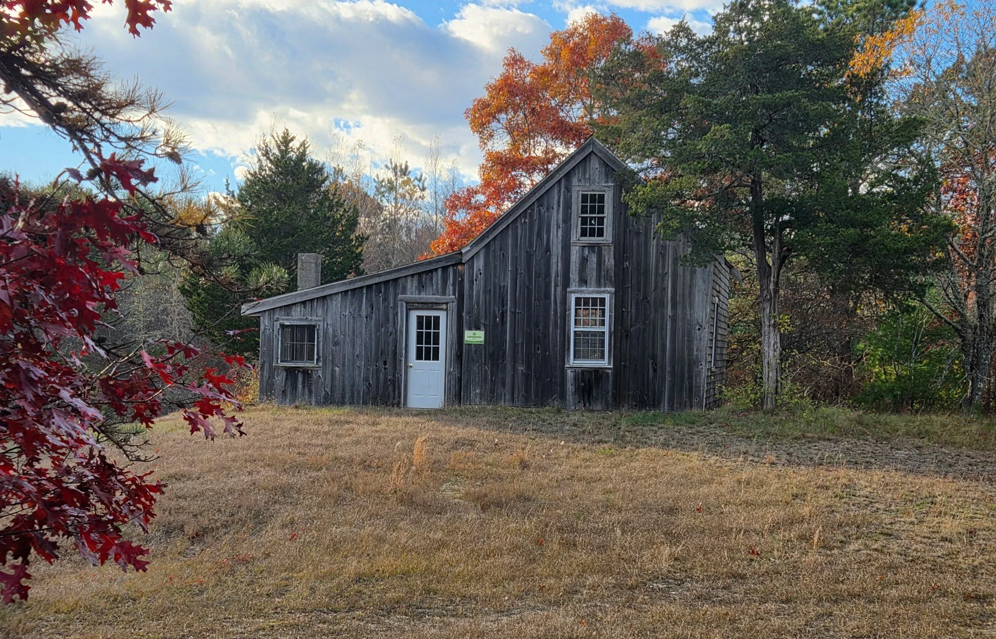
Great River Preserve in Bridgewater offers a unique example of a very different kind of history.
The preserve sits near the headwaters of the Taunton River. If you read our April 2024 history of the Taunton River watershed, you might remember that the retreat of the last glaciers around 12,000 years ago left this area covered in sandy soil and mud—not the rocks and boulders so prevalent elsewhere in Southeastern Massachusetts. Much later, the Taunton River's slow current would prove unsuitable for the hydropower generation that elsewhere fueled mills and factories. The land has thus continued to support high-quality forests and farms for generations.
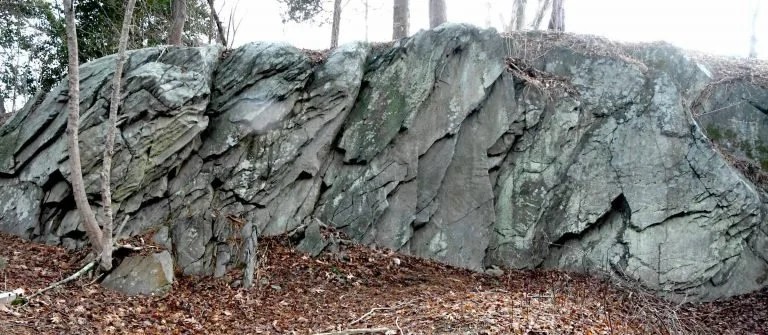
Sachem Rock. Source: Sowams Early History
Early History
In 1647, a group of settlers known as the "Conihassett Partners" (derived from the Wampanoag name for a section of present-day Scituate) decided to expand their land holdings beyond the coast and obtained the first land grant for a large inland area. In 1649, at a place called Sachem Rock (close to today's Great River Preserve), the Wampanoag sachem Massasoit met with colonists including Miles Standish. There, Standish purchased 14 square miles of land that came to be known as Old Bridgewater. The purchase price included "7 coats, 9 hatchets, 8 hoes, 20 knives, 4 moose skins, and 10 and 1/2 yards of cotton." This is believed to be the first signed agreement in North America between the colonists and Native people.
Soon, colonists settled in the area, and Old Bridgewater split into four Bridgewaters—East, West, North (now Brockton), and Bridgewater proper. One of the earliest farms was Sachem Rock Farm in East Bridgewater, established in 1665. As the area grew, present-day Auburn Street became a main thoroughfare. In 1790, the Auburn Street Bridge, eventually known as the Covington Bridge, was built, connecting Bridgewater with Halifax to the east and Middleboro to the south. This bridge operated for over 200 years through multiple replacements and repairs until 1995, when it was finally dismantled.
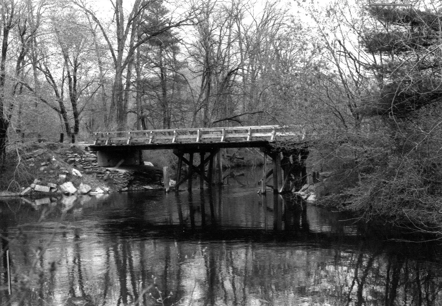
Auburn Street Bridge, 1981. Source: Recollecting Nemasket
In 1770, a Cape-style house that came to be known as the Leonard–Jackson House was built on a large farm on Auburn Street. This house has been in continuous use since, owned by the Leonard, Jackson, Brooks, and Belchunas families, among others, before ending up with the Lehtola family from 1945 to the present day.
From the late 1600s until the early 2000s, the land of Great River Preserve was in continuous use as a farm, pasturing cattle and horses and producing corn and hay. Unlike almost every other property in the region, this land likely looked in the 1700s much the same as it does today.
Protecting the Land
Owners Peter and Rita Lehtola were concerned that as they phased out farming activities, the land could be divided, developed, and changed forever. Then, Wildlands Trust Board Chair Howard Randall approached the Lehtolas with an idea of how it could be preserved. In 2008, the Lehtola family agreed to sell 230 acres of the property to MassWildlife and Wildlands Trust. Of those acres, 125 became Great River Preserve, while the remainder augmented MassWildlife’s Taunton River Wildlife Management Area, which today totals 349 acres. To make the agreement possible, Wildlands’ Board of Directors agreed to change a longstanding "no hunting" policy on their properties and allow hunting at Great River in a carefully regulated manner. This marked an important public-private collaboration, and a blueprint for future preservation efforts.
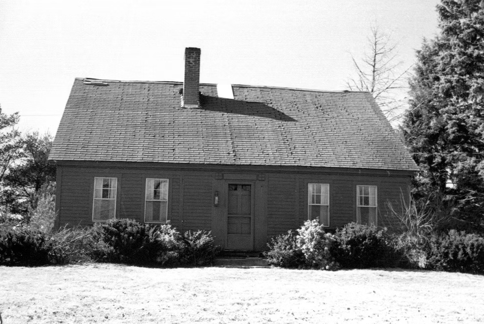
Leonard–Jackson House, 1984. Source: Bridgewater Archive
The protection project forever secured the future of a 1,400-acre open space corridor along 1.5 miles of the Taunton River. Since the acquisition, Wildlands has worked diligently to keep the fields hayed and forests healthy, so that the land’s character can persist at a time when farms of all kinds are going out of business and being swallowed up by development.
We hope you will visit Great River Preserve and seize the rare opportunity to see what farmers and settlers saw for 300 years.
A special thanks to the Lehtola family, without whose insights and recollections this piece would not have been possible. And as always, thanks to Thomas Patti, Wildlands’ Communications Coordinator.
Resources
“Leonard-Jackson House,” Bridgewater Archive. bridgewaterarchive.com/locations/houses/13
“Sachem’s Rock where Ousamequin traded with Myles Standish for Satucket lands in 1649.” Sowam’s Early History. sowamsearlyhistory.org/sachems-rock-where-osamequin-traded-with-myles-standish-for-satucket-lands-in-1649/
“Auburn Street Bridge,” Recollecting Nemasket. nemasket.blogspot.com/2013/03/auburn-street-bridge.html
East Bridgewater Library: eastbridgewaterlibrary.org
“Human History of Wildlands: The Taunton River Watershed," Wildlands Trust.
“Taking the Long Way Around,” John Stilgoe, Boston Globe. March 14, 2004.
Interview with Peter Lehtola, March 26, 2026.
Human History of Wildlands: A Q&A with Skip Stuck
What past lives have Wildlands Trust’s conservation areas lived?
Wildlands volunteer Skip Stuck will follow every clue. Two years ago, Skip launched “Human History of Wildlands,” a blog series that explores the cultural legacies of the lands that Wildlands protects. Sixteen articles later, we asked Skip to reflect on his work so far.
What past lives have Wildlands Trust’s conservation areas lived? Some clues linger on the landscape. Others collect dust in the annals of local historical societies—or survive only in the memories of past caretakers.
Wildlands volunteer Skip Stuck will follow every clue. Two years ago, Skip launched “Human History of Wildlands,” a blog series that explores the cultural legacies of the lands that Wildlands protects. Sixteen articles later, we asked Skip to reflect on his work so far.
Wildlands: Why did you start this project?
Skip: 2026 marks my 10th year as a Wildlands Trust volunteer. When I started, I was 67, recently retired, and happy to help Wildlands’ stewardship department with trail work and carpentry. I still am. But at 77, neither my strength nor my stamina is what it once was. I love the Trust’s community-focused mission and impact, so I asked myself how I could still contribute once my days of lugging benches into the woods were over.
While leading group hikes for Wildlands, I became intrigued by the trail names, old foundations, and stone walls I came across. The Wildlands website provides great descriptions of each preserve’s "natural history," of the forests, fields, and fauna that hikers enjoy on our trails. But my general knowledge of “human history” told me that, at one point or another, people have lived or worked on nearly every acre of our regional landscape. Our “wildlands” may look untouched today, but they would surely look different if not for millennia of encounters with human hands.
Simply put, I started writing this series to explore the impact of humans on nature. As a volunteer hike leader, I also wanted to add some historical perspective to what hikers were seeing on the trails.
How has this project changed the way you think about local history?
The history many of us learned in school was written by European men. From their perspective, anything that wasn’t mowed down or built up was wilderness, and history started in 1620. The whole story is much more complicated—and harder to find. Only by researching Indigenous oral histories, local archaeology, and the observations of the earliest European explorers did I begin to realize how much we don’t know. In some places, ancient shell middens and fish weirs provide the only remaining evidence of human stories we will never fully know.
Even if every artifact and memory throughout history had been perfectly preserved, one objective “truth” would remain difficult (if not impossible) to locate. Every story is tinted by the experiences and biases of the interpreter. Read one colonial and one Indigenous account of King Philip’s War, and you will be shocked that they describe the same event.
I was also struck by how much of what we observe in nature today can be explained by historical human use. This prompts some difficult questions for Wildlands, none larger than the very definition of “preservation.” When should we repair damage done by years of human abuse? When should we simply "let nature take its course”? When should we allow a hayfield to return to a forest, or a cranberry bog to a swamp? And what should we do about the invasive plants that we’ve spread across the globe?
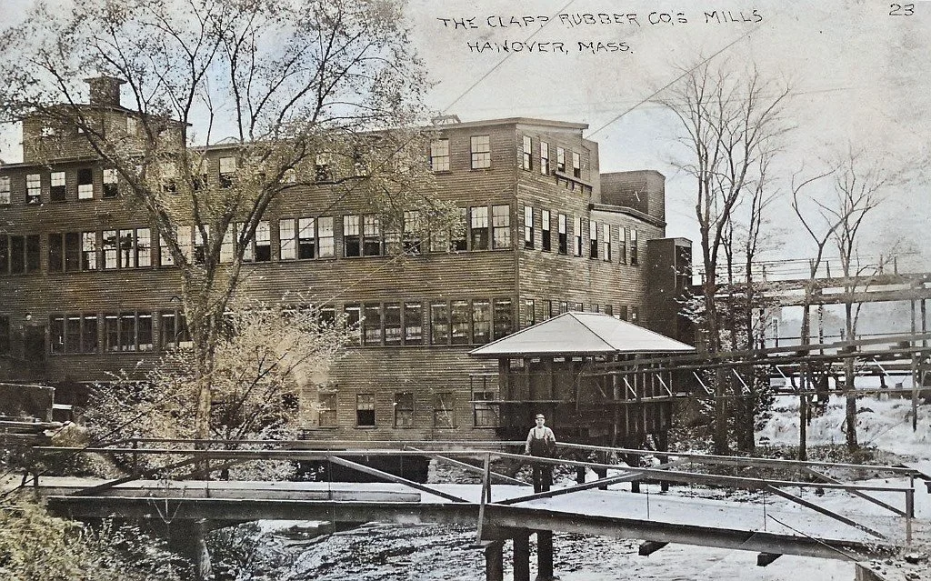
The banks of the Indian Head River in Pembroke, Hanover, and Hanson were once a hotbed of industrial development, including the Clapp Rubber Mill (pictured above). Today, the area supports the scenic Indian Head River Trail, including Wildlands’ Tucker Preserve. The dam that fueled the mill is still intact (pictured below), but the mill itself is gone, save for scattered remains in the forest. Revisit Skip’s history of the Indian Head River here.
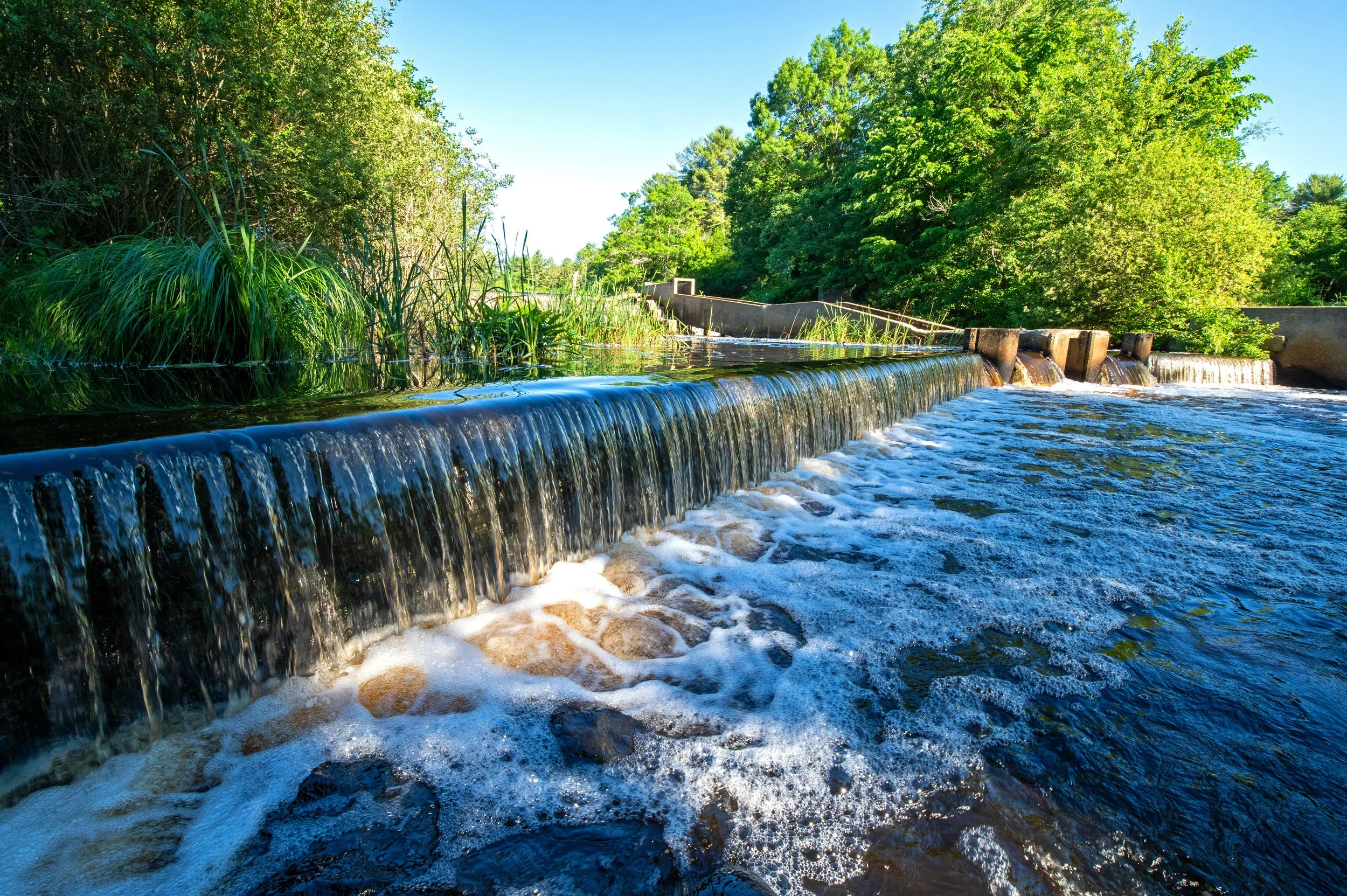
Photo by Rob MacDonald.
What patterns have you observed across these preserve histories?
Across every property I’ve researched, one pattern has held true: what happens to land hinges on its utility to people. Humans have always valued land based on its ability to support their survival and prosperity. When land couldn’t help them, they changed it. Tribes burned underbrush to improve travel, food, and safety. Settlers cleared forests and dammed rivers to create grist- and sawmills. As times changed, farms replaced forests, factories replaced farms, and cities replaced towns. When changes in population, technology, and industry ended the usefulness of land, everything returned to forest. Even today, when more people appreciate nature’s intrinsic value, many preservation efforts must still be justified by their benefits to drinking water, scenic vistas, and other human assets.
What has been most difficult about writing this series?
Earlier, I suggested that uncovering a truthful and objective history might be impossible. However, its impossibility does not diminish the value of the search. Let's return to King Philip's War. If you want to learn about the conflict, you might start with written primary sources. Yet those sources would almost certainly reflect only the perspectives of white, male Puritans or Pilgrims. You might widen your search to include information from Indigenous sources, but very little is written, and oral traditions are harder to access. One might visit the battle sites, but even archaeological evidence can yield vastly different interpretations.
So why look for the truth if you can't find it? I would argue that the act of searching, of listening to contrary points of view and seeing the world through the eyes of another, teaches us about human fallibility—and therefore the need for humility. Studying history can't assure us of the facts. But it can absolutely help us learn about each other.
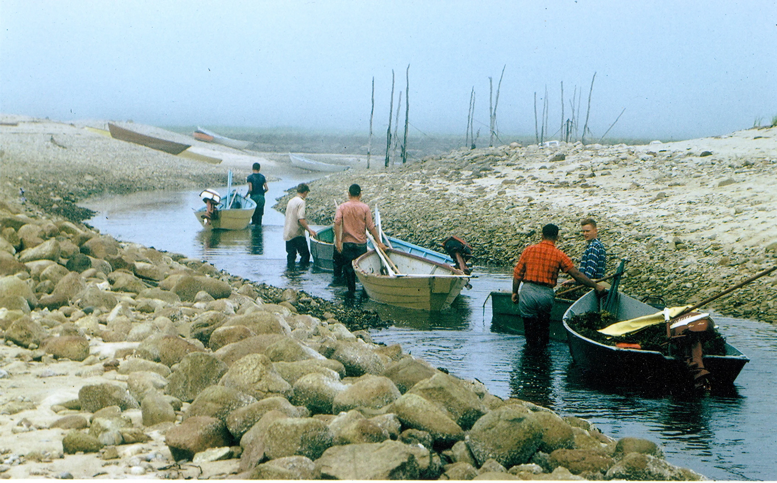
Skip’s first article in the series retraced the history of Shifting Lots Preserve in Plymouth, including the once-vibrant mossing industry in Ellisville Harbor. Photo from 1969, courtesy of Roger Janson, via Friends of Ellisville Marsh.
If readers could take away one thing from your series, what would you want it to be?
To take good care of a piece of land, you need to know its past. Throughout history, humans have caused widespread environmental damage. It’s a sobering fact with a silver lining: humans have the power to change the environment for the worse, so they also have the power to change it for the better. To do so, we need to understand how we’ve historically abused that power. Only then can we chart a new path forward.
How and why should readers get involved with local history?
You can help us find answers to our many unresolved questions—and to many more questions we haven’t yet thought to ask. The more people who participate in local history research, the more diverse sources we can uncover, and the more complete our history becomes. You don’t have to be an academic. Photos, maps, family stories, and personal memories can all be extremely valuable and paint a more colorful picture of the past.
Not long ago, I wrote a history of Willow Brook Farm in Pembroke. There was plenty of written information about the area, but I knew my account needed more photos to come to life. We published the piece, along with a plea for readers to lend their insight. To my pleasant surprise, two longtime residents of the historic farm property honored our request. The Pelleys met us at Wildlands’ headquarters, their arms and minds brimming with historical photos, documents, and stories that we published as an addendum to the initial piece. Many of the other entries in this series have relied greatly on interviews with family members, prior owners, neighbors, and others.
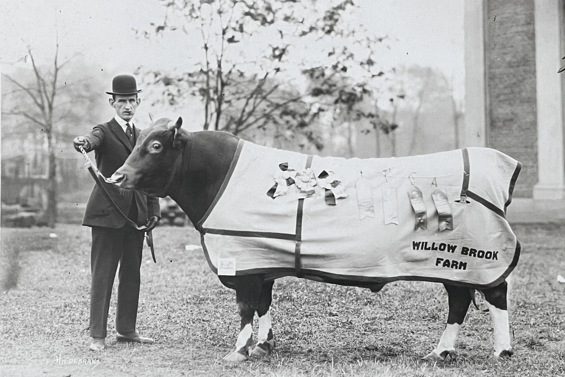
Andrew and Ann Dee Pelley, neighbors of Willow Brook Farm, shared many historical records with us, including this photo of a Guernsey cattle from Willow Brook Farm that won 1st Prize and Grand Champion at a show in Springfield in October 1917. Photo courtesy of the Pembroke Historical Society.
You can also provide feedback on past and future entries in the series by commenting below an article or sending an email to communications@wildlandstrust.org. I try my best to get my facts straight, but I always knew I’d make mistakes. I’ve received and incorporated corrections before, and I expect and welcome corrections again. If you've enjoyed these histories, I guarantee that your willingness to share information and feedback will make them even better.
Human History of Wildlands: Articles So Far
Pudding Hill Reservation, Marshfield
Old Field Pond Preserve, Bourne
Hoyt-Hall Preserve, Marshfield
Cow Tent Hill Preserve, Duxbury
Brockton Audubon Preserve & Stone Farm Conservation Area, Brockton
Delano Memorial Forest & Rounseville II Preserve, Rochester
Halfway Pond Conservation Area, Plymouth
Crystal Spring Preserve, Plainville
Tucker Preserve & Indian Head River Trail; Pembroke, Hanover & Hanson
Stewart/Person Preserve, Kingston
Human History of Wildlands: Pudding Hill Reservation
As with many of the properties featured in this “Human History of Wildlands” series, the present-day tranquility of the area belies the long human impact on the land in and around Pudding Hill Reservation. Like Hoyt-Hall Preserve and Phillips Farm Preserve, other Wildlands properties in Marshfield, this land has been in constant use for generations, including Native Americans for thousands of years and European settlers over the last four centuries. With human habitation comes change.
Chandler’s Pond at Pudding Hill Reservation in Marshfield.
By Skip Stuck, Key Volunteer
Pudding Hill Reservation in Marshfield was donated to Wildlands Trust in 1991 by Elizabeth Bradford. Though relatively small at 37 acres, the preserve has a varied terrain, including an upland ridge, frontage on Chandler’s Pond (from which a bubbling brook becomes the South River), and the 128-foot Pudding Hill itself. A mowed 0.4-mile trail provides easy access to the preserve from the parking area on Pudding Hill Lane. Today, Pudding Hill Reservation offers visitors a relaxing sanctuary just minutes from Marshfield Center.
As with many of the properties featured in this “Human History of Wildlands” series, the present-day tranquility of the area belies the long human impact on the land in and around Pudding Hill Reservation. Like Hoyt-Hall Preserve and Phillips Farm Preserve, other Wildlands properties in Marshfield, this land has been in constant use for generations, including Native Americans for thousands of years and European settlers over the last four centuries. With human habitation comes change.
The North and South Rivers have always been heavily utilized by Native people, including the Massachusett Tribe, for hunting, fishing, and shell fishing, and as water highways for transport and trade throughout Southeastern Massachusetts.
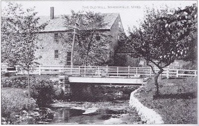
Marshfield’s first gristmill, founded in 1654 by William Ford and Josiah Winslow. Photo circa 1940. The site is now Veterans Memorial Park, directly adjacent to Pudding Hill Reservation. Via North and South Rivers Watershed Association.
After 1620, Pilgrims from the Plymouth Colony were quick to see these benefits. Settlers began to arrive in Marshfield before 1640. As you will remember from other installments of this series, one of the first orders of business in areas with flowing water was the building of mills—especially gristmills. With this goal in mind, Samuel Baker, John Adams, and James Pitney purchased the Pudding Hill property along the South River. By 1659, Samuel Baker's gristmill was up and running, made possible by the damming of the South River to create Chandler’s Pond. Other dams and mills followed in 1706 and 1771.
But bigger things were on the horizon. In 1810, as the Industrial Revolution was beginning, waterpower was once again instrumental in the establishment of the Marshfield Cotton and Woolen Manufacturing Company. A network of support enterprises helped the company thrive through the first half of the 19th century. Leavitt Delano's blacksmith shop and Elijah Ames' carpentry shop, among others, produced barrels, tools, and other necessities. Other factories produced textile dyes. Farming was largely replaced by factory work, which necessitated housing, boarding houses, a store, and a school.
However, the second half of the 19th century was the time of "Manifest Destiny," and throughout New England, the opening of the American West drove a significant emigration of local farmers to the Great Plains and beyond. In addition, larger manufacturing cities such as Brockton, Lowell, and Lawrence drew workers away from the smaller towns. The Cotton and Woolen Company closed in 1860, but later Gilbert West purchased the water rights to the property and ran a saw and gristmill until the 1920s.
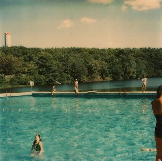
Camp Milbrook campers swimming in Chandler’s Pond in 1967. Via UMass Boston, Joseph P. Healey Library.
Marshfield was gradually becoming the seaside vacation and bedroom community of today. In the 1920s, Pudding Hill and Chandler’s Pond became the summer home of the Bradford family. In the 1950s, the Bradfords moved in full-time. In an interview, Elizabeth Bradford, a direct descendant of Plymouth Colony governor William Bradford, relates the history of Pudding Hill as a quiet, peaceful refuge—not just for her family, but for many others. From about 1938 to 1985, Pudding Hill was the location of Camp Milbrook, a summer camp that served hundreds of children over its lifetime. It also gained local fame as a training camp and teaching clinic for the Boston Celtics, where coach Red Auerbach and stars like Larry Bird, Kevin McHale, and Robert Parish taught basketball fundamentals to summer campers.
After the camp closed, the Bradfords started thinking about what would happen to the property they loved. Housing and other development was erasing much of the historic farmlands and woodlands in town, and Elizabeth Bradford was committed to saving Pudding Hill and preserving its beauty. In 1991, she donated it to Wildlands Trust. Today, it is a popular destination for hikers, bird watchers, and nature lovers who use its trails and open space for all the outdoor activities that Ms. Bradford intended. It will remain as such forever under Wildlands’ stewardship.
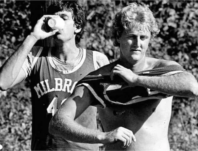
Kevin McHale and Larry Bird at Camp Milbrook. Video: Red Auerbach instructs kids at Camp Milbrook in Marshfield in 1974. Source: GBH Archives.
We hope you will take advantage of what Wildlands Trust offers in Marshfield and throughout Southeastern Massachusetts. Please come and visit. To learn more, look over the following resources used in researching this article:
The Power of Water: Milling and Manufacturing in the North River Valley by Kezia Bacon, NSRWA, April 2008.
An excellent piece that delves more deeply into the history and stories of the entire North and South River watershed, including several other areas that Wildlands preserves, such as Hoyt-Hall Preserve, Cushman, Preserve, Willow Brook Farm, Tucker Preserve/Indian Head River Trail, Phillips Farm Preserve, and Cow Tent Hill Preserve. I thank Ms. Bacon for writing it and hope you will enjoy reading it.
Marshfield: A Town of Villages 1640 - 1990, by Cynthia Hagar Krussel and Betty Magoun Bates, Historical Research Asociates,1990.
Interview of Elizabeth Bradford, by Kezia Baker, WaterWatch (the newsletter of the North and South Rivers Watershed Association), Sep. 1993.
North and South Rivers Watershed Association website: www.nsrwa.org.
Pudding Hill Reservation, Wildlands Trust: wildlandstrust.org/pudding-hill-reservation.
As always, a special thanks to Thomas Patti for editing this piece.
Human History of Wildlands: Old Field Pond Preserve
Like the Winslows in last month's history of Hoyt-Hall Preserve and the Barkers of Willow Brook Farm, Old Field Pond Preserve’s history is as much about a family as it is about a parcel of land. Whenever a family is associated with a landscape over a long period of time, their imprint is palpable. You'll see this clearly in the story of the Ingersolls.
The cranberry shack at Old Field Pond Preserve once housed the bog supervisor.
By Skip Stuck, Key Volunteer
Old Field Pond Preserve is a 145-acre property on Bournedale Road in the town of Bourne. It boasts a wide variety of features—ponds, fields, wetlands, and forests. Wildlife including waterfowl, deer, coyotes, small game, and endangered northern red-bellied turtles are abundant. Rare plant life, such as the Plymouth gentian and carnivorous sundew, find refuge here. It is a truly wonderful place.
Readers who are familiar with Wildlands’ properties might never have visited or even heard about Old Field Pond Preserve. Although it is one of Wildlands’ most beautiful properties, it has no open public access, so Wildlands does not highlight it on its website. The preserve is "landlocked" by private property. Although there is no parking and visitors may not walk in on their own, there are many opportunities to enjoy the property. More on this later.
Like the Winslows in last month's history of Hoyt-Hall Preserve and the Barkers of Willow Brook Farm, Old Field Pond Preserve’s history is as much about a family as it is about a parcel of land. Whenever a family is associated with a landscape over a long period of time, their imprint is palpable. You'll see this clearly in the story of the Ingersolls.

Hike & Hops at Old Field Pond Preserve in November 2023.
Early history
As the glaciers retreated about 12,000 years ago, meltwater flowed south and created a myriad of rivers and streams in the outwash plains. Native Americans soon took advantage of the opportunities for fishing and shellfish and settled the area that they called Comassakumakanit. What was known as the Manomet River by the Natives and Monument to the English flowed from Great Herring Pond into Buzzards Bay. As its name indicates, Great Herring Pond was rich in herring, and its banks were moist and fertile to farm. The area was and still is home to the Herring Pond Wampanoag Tribe.
The Tribe continues to own 400 acres near Old Field Pond Preserve. Chamber Rock, Burying Hill, Wishing Rock, and Sacrifice Rock are all local features of cultural and historical significance to the Tribe. This year, scientists used ground-penetrating radar to locate old Wampanoag burials at Burying Hill, providing new evidence in support of the Tribe’s oral history dating back centuries. The Herring River Trail, now called Herring Pond Road, and Bournedale Road are important ancient thoroughfares still in use today.

Historical plaque at Burying Hill, near Old Field Pond Preserve in Bourne. In addition to a burial ground, the area was the site of the first meeting house for Native Americans in Plymouth Colony.
European settlement
At the mouth of the Monument River, about a mile from Old Field Pond Preserve, is the Aptuxet Trading Post, founded in 1627 by the Dutch from New York and the Plymouth Pilgrims. It is reputed to be the first such post in New England and the site of the earliest recorded use of "Wampum," beads made from quahog clam shells as currency.
As Plymouth Colony expanded south to Cape Cod, the first town to be established was Sandwich in 1637. The area now known as Old Field Pond Preserve was in the western section of town. Among its first settlers was Colonel John Bourne, patriarch of a family influential in the area for the next 250 years. In 1695, the Herring River Grist Mill was built. Timber, shipbuilding, farming, salt hay production, fishing, and glassmaking were the principal industries for the area, with cranberry production becoming increasingly important along the way.
In the 1780s, the main house on the Old Field property was built and occupied by the family of Jonathan Bourne. It was also the site of the West Sandwich post office. By the late 19th century, other businesses grew in the area, including the Holway Axe Factory and the Keith Car Works. A railroad line also served the area. The growing community soon decided to break away from Sandwich, and in 1884, the town of Bourne was incorporated.
At about this time, the area surrounding Old Field consisted of a large section of woods and farmland. It was known as Colonel Horton's Fishing Club, a private enterprise catering to the emerging summer tourist industry. Change was on the horizon. The Monument River was to disappear as work on the long-contemplated Cape Cod Canal began. Completed in 1914, the canal split Bourne in half, putting the area's fishing industry in jeopardy. So that the Cape wouldn't become an island, three bridges were built, one for trains and two for ground transport. The Bourne Bridge will soon come into play in this history.
The Ingersoll era
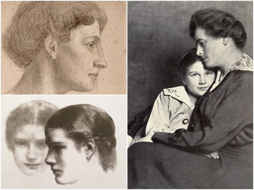
Kahlil Gibran’s sketches of 14-year-old Hope Ingersoll while staying at Bay End Farm in 1918. Via kahlilgibran.com.
In 1906, the fishing club was sold to the Garland-Ingersoll family, led by Mary Tudor Garland Ingersoll, who immediately transformed the 900-acre lot into Bay End Farm.
Mary and her husband were wealthy socialites. Mary was a well-known and passionate patron of the arts. She immediately set out to create a place for artists to stay, inspire each other, and create. She had prefabricated cottages built for artists of all kinds to visit, several of which are still in use today. Mary, a close friend of painter Georgia O'Keeffe, played host to many notable figures of her time, including Mark Twain and artist and writer Kahil Gibran, who wrote part of his famous book The Prophet while residing at the farm. The artist's colony flourished until the 1950s. The property was also made available to provide housing for military officers during World War I.

Postcard depicting Bay End Farm in the early 1900s.
Mary's other passion, and one carried on and championed by her daughter, Hope Garland Ingersoll, was the preservation of their farm, one of the last large properties in the area. At some point, Hope changed the name of Bay End Farm to Grazing Fields Farm. The property became well-known for its progressive land use, eschewing pesticides and herbicides, and for its livestock breeding, famous for its prize-winning Welsh ponies, Guernsey cattle, Montdale sheep, and Sealyham Terriers.

Grazing Fields Farm exists today as a horse farm on a portion of the Ingersolls’ original property.
Grazing Fields Farm operated in this manner until 1957, when Hope Ingersoll gained local and even national fame during her 25-year fight to save the property from a state highway expansion. The project’s goal was to speed up summer automobile access to the Bourne Bridge. Officials would have invoked eminent domain to break up the Ingersoll property. Hope contested the state's architectural plan and privately paid architects to design an alternative route plan. In 1982, aided by new federal environmental regulations, Hope prevailed. The story gained recognition throughout the environmental movement and in the news, including the New York Times, whom Hope told, “I think it’s true that you can fight City Hall. But you’ve got to have a lot of persistence, and help—and luck. We started this long before anyone was worried about the environment. … We have always been concerned with protecting the land.”

Hope Ingersoll. Photo courtesy of Kofi Ingersoll.
Old Field Pond Preserve
In 1983, the Ingersoll family decided to donate 145 acres in the middle of their property to Wildlands Trust so it could be protected in perpetuity. This was the beginning of Old Field Pond Preserve. The name Grazing Fields Farm applies today to the horse farm on the southeast side of Bournedale Road. The rest of the historic Ingersoll land, abutting Old Field Pond Preserve on the northwest side of Bournedale Road, has reclaimed the name Bay End Farm. Hope’s grandson, Kofi Ingersoll, owns and operates this organic produce farm. In partnership with the Ingersoll family, Wildlands uses Old Field Pond Preserve in several ways. Wildlands and Bay End Farm staff and volunteers guide hikes on the property throughout the year. The farm also provides environmental education to Wildlands’ Green Team, Envirothon Team, and other youth programs, and assists Wildlands staff in the maintenance, trail trimming, and haying of the preserve.
We hope you will join us for our next guided hike or volunteer event at Old Field Pond Preserve. Sign up for our E-News and visit wildlandstrust.org/events to stay updated on the latest opportunities to explore this special place. You will not regret it.

Kofi Ingersoll. Photo by Drew Lederman.
Learn more
Resources utilized in researching this history include:
The Herring Pond Wampanoag Tribe: herringpondtribe.org
Bourne Historical Society: bournehistoricalsociety.org
American Aristocracy: americanaristocracy.com
Grazing Fields Farm: grazingfields.com
Kahil Gibran website: kahlilgibran.com/latest/132-the-house-of-the-prophet-gibran-at-mrs-garlands-farm
"Farmer Wins 25 Year Fight over Cape Road," New York Times, 10/10/82: nytimes.com/1982/10/10/us/farmer-wins-25-year-fight-over-cape-road.html
50 Remarkable Years, 50 Remarkable People, “The Ingersoll Family,” Wildlands Trust: wildlandstrust.org/anniversary-book-blog/2024/4/9/ingersoll-family
Interview with Kofi Ingersoll, 10/31/25.
A special thanks to Kofi Ingersoll for his recollections and photos, and to Thomas Patti for editing this history.
Human History of Wildlands: Hoyt-Hall Preserve, Marshfield
Hoyt-Hall Preserve in Marshfield is one of Wildlands Trust's most popular preserves. Acquired in 2000, the property was quickly designated as a "showcase" preserve owing to its diverse woodland and wetland habitats and associated wildlife. Containing 123 acres and bordering 82 acres of additional conservation land, Hoyt-Hall protects a significant assemblage of open space in a growing town.
Yet there is another story here. Hoyt-Hall's human history spans over 10,000 years of settlement and change.

By Skip Stuck, Key Volunteer
Hoyt-Hall Preserve in Marshfield is one of Wildlands Trust's most popular preserves. Acquired in 2000, the property was quickly designated as a "showcase" preserve owing to its diverse woodland and wetland habitats and associated wildlife. Containing 123 acres and bordering 82 acres of additional conservation land, Hoyt-Hall protects a significant assemblage of open space in a growing town.
Yet there is another story here. Hoyt-Hall's human history spans over 10,000 years of settlement and change. Archeological evidence shows that Native people followed the retreating Laurentide ice sheet north, first as nomadic hunters and soon as settlers. Remnants of permanent dwellings have been excavated in Marshfield, dating back at least 3,000 years. The area that now contains Hoyt-Hall Preserve was partly a saltwater marsh with access to the ocean, and shell deposits show that it was well utilized by the Natives for fishing. By 1600, it was used seasonally by the Wampanoag Tribe as a summer home to take advantage of these resources. They wintered on the lands known today as Lakeville and Middleborough. The Wampanoags called the present-day Marshfield area "Missacautucket," and Massasoit was their powerful sachem.
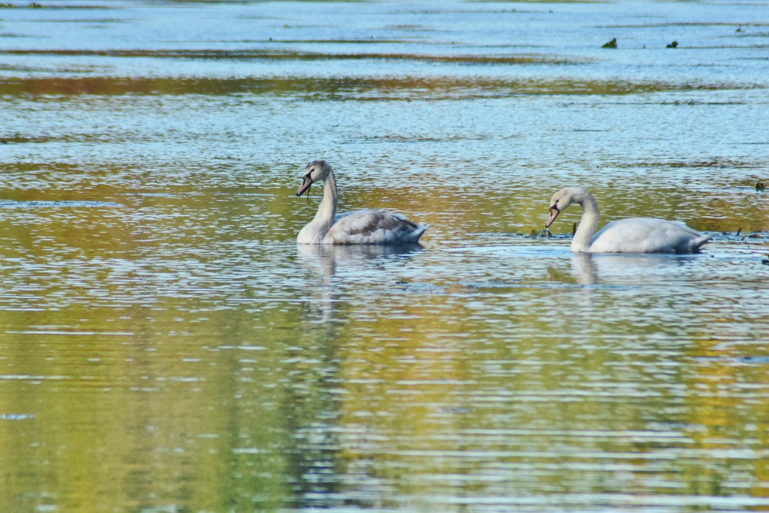
Swans on Long Tom Pond. Photo by Mike Arsenault.
The Value of Relationships
Upon the Pilgrims’ arrival to Plymouth Harbor, settling on lands outside the Colony's patent was prohibited. Early on, a few colonists managed to do so anyway. One was William Green in 1623, who established a commercial fishing post on what is now known as Green's Harbor. But general settlement was not permitted until 1632, when land grants began to be awarded. In 1636, Plymouth Colony governor Edward Winslow was granted a large tract of land, including the current Hoyt-Hall property. The Winslow family, along with the whole Plymouth Colony, was successful, due in large part to the strong relationship between Governor Winslow and the Wampanoag leader Massasoit, which endured for nearly half a century. More on the importance of relationships history later.
In 1637, the Pilgrim Trail, then called Green's Harbor Path, was the first general court-ordered road in the Colony. It passes along the border of Hoyt-Hall Preserve, as does King Philip’s path, an ancient and famous Native trail. Three Winslow family homesteads were built on the Hoyt-Hall property, much of which remained with the family until 1822. Two colonial governors, Edward and his son Josiah, lived and prospered on the land, as did Edward's adopted son, Peregrine White. White was born in 1620 on the Mayflower, becoming the first Englishman to be born in America.
In 1640, the Town of Marshfield (initially called Rexhame) was incorporated and grew quickly with new settlers. While many surrounding towns suffered much death and tragedy during King Philip's War in the 1670s, Marshfield remained relatively unscathed due to the Winslow family's strong relationship with the Wampanoag Tribe.
Hoyt-Hall Transformed
Because much of Hoyt-Hall was then tidal marshland, in 1675 a dam was built to create Long Tom Pond (named after a local Native who was killed in King Philip's War), providing a freshwater source first for general farming and later for cranberry growing.
Historic Winslow House. historicwinslow.org
The Revolution
Directly adjacent to Hoyt-Hall Preserve is the Isaac Winslow house. Built circa 1699, it is the oldest home in Marshfield. Isaac was a well-known physician with a reputation for serving both settlers and Natives. He inoculated many against smallpox and other diseases in the early 1700s. However, as relationships between the colonists and the English crown deteriorated, the Winslow family became well-known Loyalists, and Isaac's house became a Loyalist meeting place. Relations between the Patriots and Loyalists were tense, and the Loyalists pressed for British troops to be brought in to protect them. A force of 114 troops landed, but fighting was eventually avoided, once again as a result of the Winslow family’s strong relationships with their neighbors.
Home of a Statesman
After the war ended, the Winslow family continued farming the property until 1822, when it was broken up and sold to a series of families. Some of the property returned to woodland, and some went to cranberry production. Some of it was sold to Daniel Webster, noted U.S. Congressman and Secretary of State, who lived in Marshfield from 1832 until his death in 1852. In 1884, Walton Hall purchased the Webster estate. In 1928, about 1,000 acres were purchased by Lincoln Hall, who converted some of the woodlands to cranberry bogs, which remained in production until the 1960s. During this time, the land began to take on the scenic character that we see today.
Daniel Webster Estate in 1859, as depicted on a 1909 postcard. From Patrick Browne, “The Almost-Battle of Marshfield.”
Protected Forever
In 2000, the land was sold to Wildlands with the assurance that it would be preserved in perpetuity, with beautiful trails for visitors to explore. In 2016, with funding from the Massachusetts Department of Conservation and Recreation’s Recreational Trails Program, a 1.75-mile trail loop was completed, with a parking lot on Careswell Street (Route 139). Today it is one of Wildlands’ most popular preserves, with many families enjoying this remarkable and historic property every year. Along with the adjacent Historic Winslow House, Hoyt-Hall Preserve's scenic beauty is forever linked to its rich history.
Back to Relationships...
So, you'll remember my earlier mention of the importance of relationships in the history of Hoyt-Hall Preserve. We too often think of the past in terms of events; i.e. wars, discoveries, and the like. We should not forget that nearly all historical events are either tempered or exacerbated by the human relationships that surround them. Had the Pilgrims not developed a strong relationship with Massasoit, Plymouth Colony would likely not have survived its first year. Fast forward 50 years, and it's clear that many lives were lost due to the souring of this relationship during King Philip's War. Be good to your friends.
Hoyt-Hall Preserve. Photo by Jerry Monkman.
Learn More
To learn more and visit Hoyt-Hall Preserve, explore wildlandstrust.org/hoythall-preserve. The following resources were utilized in researching this history:
“Books and History Converge at Hoyt-Hall: Former Landowner Honored by Family” by Amy Markarian, Wildlands Trust, 2022.
The Historic Winslow House: winslowhouse.org.
History of Marshfield Massachusetts by Lysander Salmon Richards, 1901.
“The Almost-Battle of Marshfield” by Patrick Browne, 2011.
“History of Marshfield,” Kiddle Encyclopedia.
“Our Story Not Theirs” by the Mattakeeset Tribe.
A special thanks to Mike Arsenault, Amy Markarian, and Thomas Patti for their assistance with this piece.